
Home \ Blog \ Structural Assessment Services in UAE: The Survey Evidence Behind the Verdict
Structural Assessment Services in UAE: The Survey Evidence Behind the Verdict
August 28, 2026

A structural assessment reaches a conclusion about whether a structure is fit for its purpose. That conclusion is only as good as the measurements underneath it. Structural assessment services in UAE depend on survey data that establishes what the structure actually is, how it has moved and what condition it is in. This guide covers what that evidence consists of and where measurement hands over to engineering judgement.
Key Takeaways
- Assessments frequently fail because the as built geometry differs from the drawings, and nobody checked.
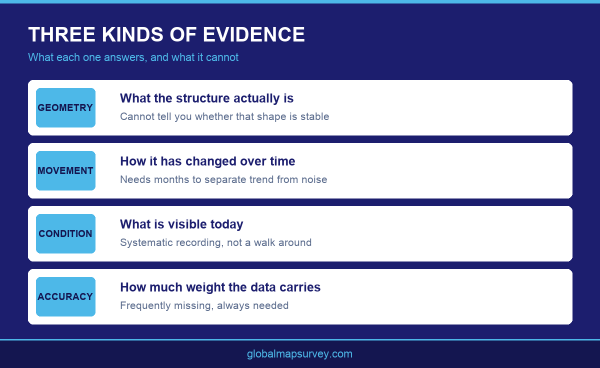
- Three evidence types support most assessments: geometry, movement over time, and recorded condition.
- The survey team measures. The structural engineer decides. Blurring that boundary weakens both roles.
Start With What the Structure Actually Is
Most assessments begin with drawings, and most drawings are wrong in some respect. Structures get modified, extended, partially demolished and repaired, and those changes rarely make it back into a record set. An assessment built on an unverified drawing is an assessment of a building that may not exist.
Verifying geometry is therefore the first survey task. Column positions, spans, storey heights, wall thicknesses and opening positions all feed directly into structural calculations, and an error in any of them propagates through the whole assessment. A measured building survey establishes the real dimensions.
Where the structure is complex or heavily modified, 3D laser scanning captures the whole form rather than selected dimensions. That completeness matters when the assessment later raises a question nobody thought to measure on the first visit, which on older buildings is close to inevitable.
Hidden and inaccessible elements are the practical limit on geometry verification. Foundations, elements buried in fabric and areas behind finishes cannot be measured without opening up, and the assessment has to state clearly which dimensions were verified and which were assumed. An assumption that is recorded as an assumption is manageable. One that quietly enters the calculation as a measurement is not.
Movement Evidence Over Time
Geometry says what the structure is now. It says nothing about whether that shape is stable. A wall that is out of plumb may have been built that way, may have moved decades ago and stopped, or may be moving today. Those are entirely different engineering situations.
Only a time series distinguishes them. Level readings across the structure show whether settlement is continuing. Crack monitoring shows whether cracks are active or dormant. Tilt measurement shows whether a lean is progressing. Each contributes a different part of the picture.
The practical difficulty is that assessments are usually wanted quickly while movement evidence takes time to accumulate. A common approach is to issue an interim assessment based on geometry and condition, with monitoring running in parallel and the conclusion confirmed or revised once a trend is established. That sequencing should be agreed at the outset rather than improvised later.
Historic movement is sometimes recoverable from the building itself. Repaired cracks, packing under bearings, adjusted door frames and previous underpinning all indicate that movement was recognised and addressed at some point. These features do not date the movement precisely, but they establish that the structure has a history, which changes how a current reading should be interpreted. Tilt evidence gathered using instruments such as a tiltmeter adds a measured dimension to that picture.
Load history is part of the movement picture as well. A structure that has recently been given a new use, a heavier finish or additional plant on the roof is carrying loads it may not have been designed for, and any movement measured afterwards has to be read in that light. Establishing what changed and when is usually a document exercise, but it directly affects how the survey data should be interpreted.
Recording Condition Systematically
Condition recording documents what is visible: cracking, spalling, corrosion staining, deflection, water ingress and previous repairs. The value is in doing it systematically, so that the absence of a defect in the record genuinely means it was not there rather than that nobody looked.
Each observation needs a location, a measurement and a date, for the same reasons that apply to any survey evidence. A note that a beam shows cracking is far less useful than a numbered observation plotted on a plan with crack widths recorded and photographs taken with a scale in frame.
Systematic recording also creates a comparison point. If the assessment recommends monitoring or repair, the condition record becomes the baseline for judging whether the situation is improving or deteriorating. Without it, a future inspection has nothing to measure against and the same uncertainty returns.
Photography should be systematic rather than illustrative. A defined sequence covering every elevation and every structural bay, with consistent naming, produces a record that can be revisited when a question arises later. A folder of images taken to illustrate particular defects cannot answer questions about the areas nobody photographed.
Where Measurement Stops
The survey team measures and records. It does not judge structural adequacy. That boundary exists because the two skills are genuinely different: interpreting whether a measured movement is acceptable requires knowledge of the structural form, its load paths, its material condition and the standards it was designed to.
Blurring the line causes problems in both directions. A survey report that offers structural opinions invites challenge and can undermine the credibility of the measurements themselves. An engineer working without a properly specified survey may build an assessment on dimensions and movement values that were never verified to a stated accuracy.
The productive arrangement is for the engineer to specify what needs measuring and to what accuracy, and for the survey team to deliver exactly that with a clear statement of the uncertainty achieved. Professional guidance from bodies such as RICS sets out how those responsibilities are usually divided on building assessment work.
This division also protects the client commercially. When a survey report and an engineering opinion come from separate documents with separate authors, each can be relied upon for what it covers. When they are merged, a challenge to the engineering conclusion can cast doubt on the measurements as well, even where the measurements were entirely sound.
Assembling the Assessment Package
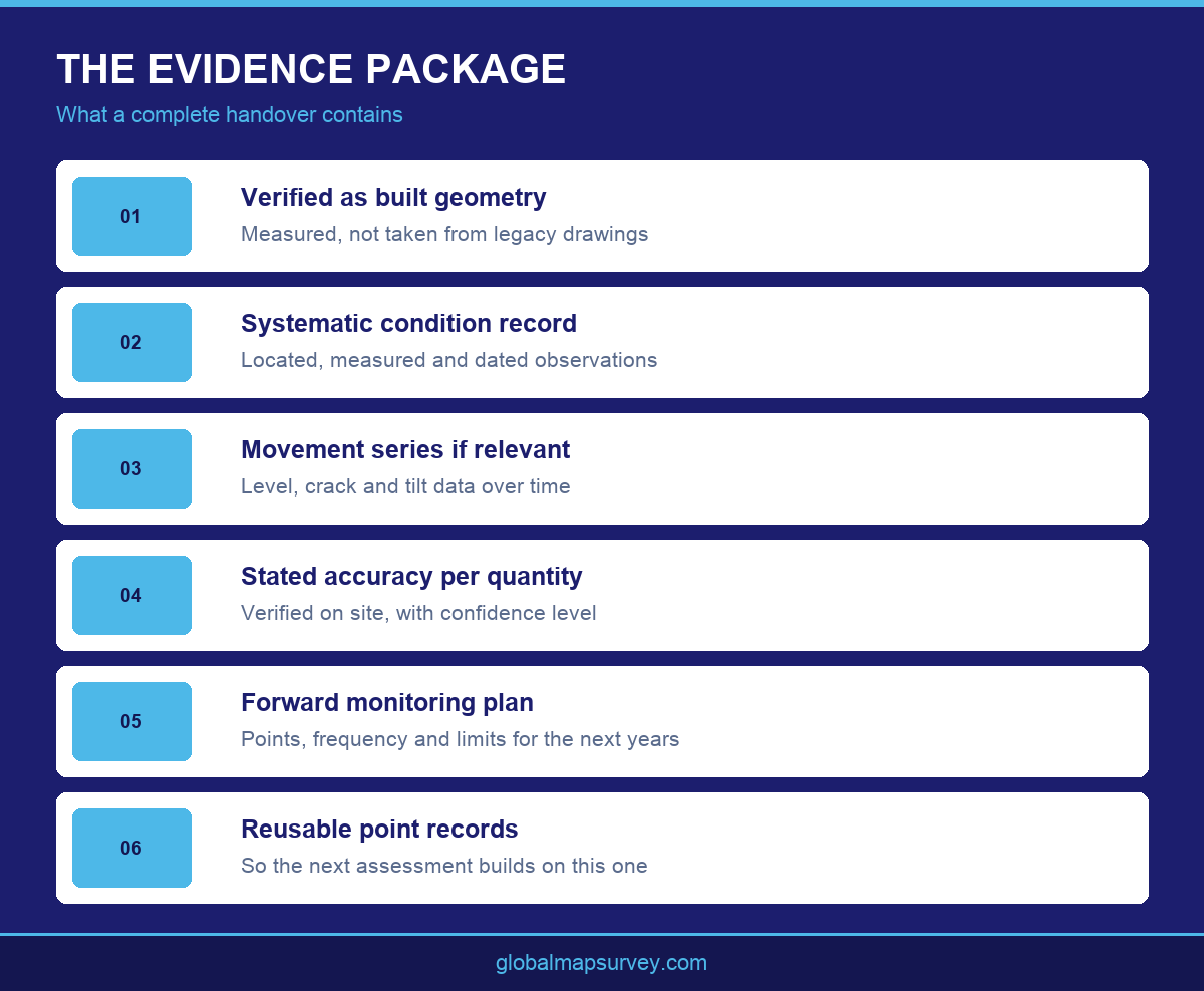
A complete evidence package usually contains verified geometry, a condition record, movement data where the question is stability, and a statement of the accuracy each was measured to. That last item is frequently missing and it is what allows the engineer to judge how much weight the data can carry.
Where the structure will remain in service and under observation, the package should also define what happens next: which points continue to be monitored, at what frequency, and against what limits. An assessment that ends without a monitoring plan leaves the owner with a conclusion but no way to know if it still holds in two years.
Finally, the package needs to be reusable. Structures get assessed repeatedly over their lives, often by different teams. Recording point locations, methods and accuracies properly means the next assessment can build on this one rather than starting again. Where the record set is being rebuilt entirely, as built surveys provide the documentation base.
Assessment packages should record what was not done as clearly as what was. Areas that could not be accessed, elements that were not opened up, and monitoring that was recommended but not instructed all belong in the record. This protects everyone involved and gives the next assessor a clear starting point rather than a set of unexplained gaps. Ongoing structural settlement surveys can then be added to the package as the data accumulates.
Conclusion
Structural assessment services in UAE stand on three kinds of survey evidence: what the structure actually is, how it has moved, and what condition it is in. Verify the geometry rather than trusting drawings, let movement data accumulate before concluding on stability, and keep the measurement and judgement roles distinct. Global Maps Survey Services provides the survey evidence behind structural assessments across Abu Dhabi and the UAE. Contact us to discuss your structure.
AN ISO 9001-2015 CERTIFIED COMPANY