
Home \ Blog \ Why Every Construction Project Should Begin with a Professional Land Survey
Why Every Construction Project Should Begin with a Professional Land Survey
July 23, 2026
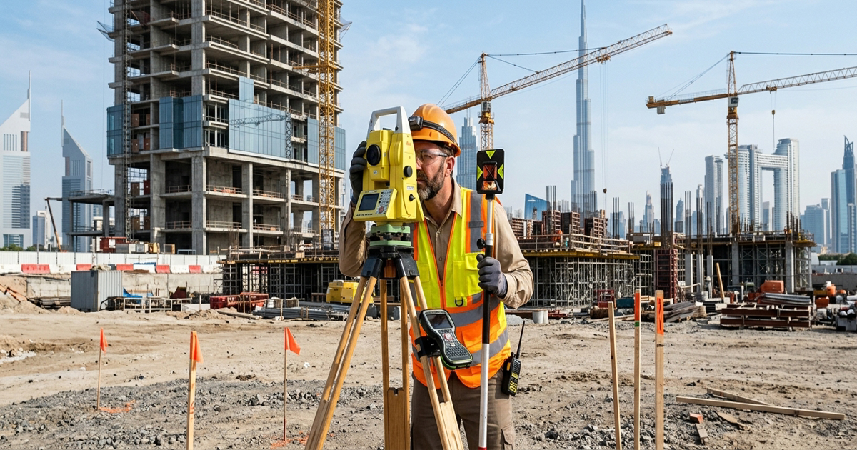
Construction survey services in UAE are not a luxury or an afterthought. They are the foundation upon which every safe, compliant, and cost-effective construction project is built. Before a single brick is laid or a foundation is dug, a professional land survey gives project teams the accurate spatial data they need to make informed decisions. Without this critical first step, even well-planned projects risk boundary disputes, structural misalignment, and regulatory penalties that can derail timelines and inflate budgets.
Key Takeaways
- Pre construction survey services in UAE establish accurate site boundaries, elevation data, and existing conditions before any groundwork begins, reducing the risk of costly design errors and legal disputes.
- Professional land survey consultancy in UAE ensures your project meets local regulatory and planning requirements from the start, preventing permit rejections and costly redesigns.
- Engaging qualified construction survey companies in UAE early in the project lifecycle saves time and money at every subsequent stage of design, construction, and handover.
What Is a Construction Survey and Why Does It Matter?
A construction survey is a systematic process of measuring, mapping, and analyzing a site to provide accurate spatial information before and during a building project. It covers everything from property boundaries and topographic features to underground utilities and elevation changes.
The data collected through construction survey services in UAE informs architectural design, structural engineering, drainage planning, and regulatory submissions. Without this data, design teams are essentially working blind, making assumptions that may prove dangerously incorrect once work begins on site.
According to the Royal Institution of Chartered Surveyors (RICS), inaccurate or absent survey data is one of the leading causes of construction cost overruns and project delays globally. Investing in professional surveying at the outset is one of the most cost-effective decisions a project manager can make.
Establishing Accurate Site Boundaries with Land Survey Services
One of the most critical functions of land survey services in UAE is the precise determination of property boundaries. Boundary errors are more common than most developers realize, and the consequences range from expensive legal disputes to demolition orders on structures built outside legal limits.
A professional boundary topographic survey identifies the exact legal extents of a site, maps existing features, and highlights any encroachments or discrepancies with title documents. This gives architects and engineers a reliable canvas on which to design structures that are positioned correctly within legal boundaries.
For large infrastructure or commercial developments, boundary accuracy is especially important. Even a small positional error of a meter or two can place a structure on a neighboring parcel, triggering legal action and requiring costly redesign or demolition. Engaging qualified land survey consultancy in UAE eliminates this risk entirely before construction begins.
Identifying Site Risks and Preventing Costly Construction Errors
Beyond boundaries, a comprehensive pre construction survey uncovers a wide range of site-specific risks that could otherwise cause serious problems during construction. These include unstable ground conditions, previously uncharted underground utilities, drainage challenges, and significant elevation changes that affect structural loads.
Pre construction survey services in UAE provide project teams with a detailed picture of existing site conditions. This data feeds directly into risk assessments, engineering calculations, and project planning. Identifying these risks early means they can be designed around, mitigated, or planned for, rather than discovered mid-construction when solutions are far more expensive.
Consider a scenario where a developer begins excavation without a thorough site survey. Unknown buried utilities or soft soil pockets are encountered unexpectedly. Work stops, specialists are brought in, redesigns are commissioned, and schedules collapse. The cost of a professional survey at the outset is a fraction of the cost of managing such surprises mid-project.
Detailed topographic survey and mapping is an essential component of any pre-construction assessment. It captures ground surface data, natural drainage patterns, vegetation, and physical features that influence foundation design and site layout planning.
Ensuring Regulatory Compliance Through Professional Survey Data
Construction in the UAE is subject to strict planning and building regulations that require accurate site data as part of permit applications and design submissions. Regulatory authorities require verified boundary data, setback measurements, and topographic information before granting development approvals.
Working with established construction survey companies in UAE ensures that all survey data is prepared to the standards required by local authorities. Professional surveyors understand the documentation and accuracy requirements that accompany planning submissions, helping developers avoid application rejections and costly delays.
A reliable land survey consultancy in UAE also keeps project teams informed about any land use restrictions, easements, or rights of way that affect the site. These legal encumbrances must be identified and respected in the design phase to avoid regulatory non-compliance during construction or at the final inspection stage.
The UAE Legislation Portal outlines various federal and emirate-level regulations governing land use and construction. Professional survey consultants ensure your project data aligns with these requirements from day one.
How Construction Survey Services Support Every Stage of a Project
The value of professional construction survey services in UAE extends well beyond the initial site assessment. Survey data supports multiple phases of a construction project, from design and planning through to construction monitoring and final handover.
During the design phase, survey data informs structural layouts, drainage designs, access routes, and landscaping plans. During construction, surveyors provide setting out services to ensure that structures are built precisely where the design intends. At project completion, as-built surveys verify that every element of the structure has been constructed in accordance with the approved design drawings.
This continuity of survey support throughout the project lifecycle is what separates successful, on-budget construction projects from those plagued by errors, rework, and disputes. Partnering with a professional surveying firm from the very beginning creates a consistent, accurate data framework that every discipline on the project can rely upon.
For projects involving earthworks, cut and fill calculations, or road construction, specialist services such as earthwork estimation for roads provide additional layers of data accuracy that prevent material wastage and cost overruns in civil engineering works.
Choosing the Right Construction Survey Partner in UAE
Selecting the right surveying partner is as important as commissioning the survey itself. The quality of survey data depends entirely on the expertise, equipment, and methodology of the team conducting the work. Poorly executed surveys can introduce errors that are just as damaging as having no survey at all.
When evaluating construction survey companies in UAE, look for firms with demonstrable experience across a broad range of project types, from residential and commercial developments to infrastructure and industrial facilities. Verify that they use modern surveying technologies, including total stations, GPS receivers, and 3D laser scanning equipment, capable of delivering the precision your project demands.
Global Map Survey provides professional land survey services in UAE and supports construction, infrastructure, and engineering projects with accurate spatial data and mapping solutions. Their team works closely with developers, engineers, and architects to deliver survey data that drives confident decision-making at every stage of a project.
Conclusion
Construction survey services in UAE are the essential first step before any project breaks ground. A professional land survey establishes accurate boundaries, identifies site risks, ensures regulatory compliance, and provides the spatial data framework that supports every subsequent design and construction decision. Skipping or cutting corners on this foundational step invariably leads to errors, disputes, and costs that far exceed the original survey investment. Whether you are planning a residential development, a commercial facility, or a major infrastructure project, partnering with qualified construction survey companies in UAE from the outset is the single most important decision you can make. Contact Global Map Survey to discuss how professional pre construction survey services in UAE can protect your project from day one.
FAQ
Q1: What are construction survey services and why are they important in UAE?
Answer: Construction survey services involve measuring and mapping a site before and during a project to provide accurate spatial data. In the UAE, they are essential for meeting regulatory requirements, avoiding boundary disputes, and ensuring structures are positioned and built correctly from the start.
Q2: When should I commission pre construction survey services in UAE?
Answer: Pre construction survey services in UAE should be commissioned before any design work begins. Early surveys ensure architects and engineers work with accurate site data, reducing the risk of costly design revisions, planning rejections, and unforeseen site conditions discovered during construction.
Q3: How do land survey services in UAE help prevent construction errors?
Answer: Land survey services in UAE identify boundary positions, elevation changes, underground utilities, and ground conditions before work begins. This data allows engineers to design around site-specific challenges, preventing structural errors, drainage problems, and misaligned foundations that are expensive to correct mid-construction.
Q4: What is the difference between a topographic survey and a boundary survey?
Answer: A topographic survey maps the physical features and elevation of a site, including ground surface, drainage, and vegetation. A boundary survey determines the legal property limits. Both are critical pre-construction tools. You can learn more about combined approaches through boundary topographic survey services.
Q5: How do construction survey companies in UAE support regulatory compliance?
Answer: Construction survey companies in UAE prepare verified boundary, setback, and topographic data required for planning permit applications. Their documentation meets local authority standards, reducing the risk of application rejections and ensuring that designs respect land use restrictions, easements, and rights of way before construction commences.
Q6: What technologies do professional land survey consultancies in UAE use?
Answer: Professional land survey consultancy in UAE firms use advanced technologies including GPS receivers, total stations, 3D laser scanners, and drone-based aerial mapping. These tools deliver high-accuracy spatial data across large or complex sites, supporting precise engineering designs and construction planning for all project types and scales.
Q7: Can a land survey help reduce overall construction project costs?
Answer: Yes. Investing in professional land survey services before construction begins identifies risks, prevents design errors, and avoids costly mid-project surprises. Accurate survey data also supports efficient material planning, as demonstrated by specialist earthwork estimation for road projects, which minimizes material wastage and budget overruns.
Q8: What is an as-built survey and when is it required?
Answer: An as-built survey is conducted after construction to verify that all structures have been built in accordance with approved design drawings. It is typically required by regulatory authorities before a building receives its completion certificate and is essential for infrastructure handover, facility management, and future renovation planning.
Q9: How does a construction survey differ from a site investigation?
Answer: A construction survey focuses on spatial data such as boundaries, topography, and positional measurements. A site investigation typically covers geotechnical assessments of soil and subsurface conditions. Both are complementary and are often commissioned together to provide a complete picture of site conditions before design and construction begin.
Q10: How do I choose the right construction survey company for my project in UAE?
Answer: Choose a construction survey company with experience across similar project types, proven use of modern surveying equipment, and a clear understanding of UAE regulatory requirements. Reviewing their construction survey capabilities and past project portfolio helps confirm they can deliver the accuracy and documentation your project demands.
AN ISO 9001-2015 CERTIFIED COMPANY