
Home \ Blog \ How Drone Surveying Is Revolutionizing Land Measurement and Infrastructure Projects
How Drone Surveying Is Revolutionizing Land Measurement and Infrastructure Projects
July 30, 2026
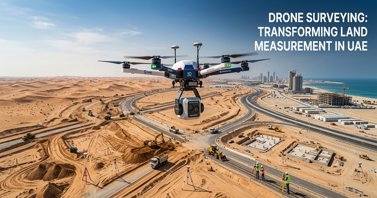
Topographic survey services in UAE have entered a new era of precision and efficiency, thanks to the rapid adoption of drone surveying technology. Across construction sites, infrastructure corridors, and coastal zones, unmanned aerial vehicles (UAVs) are replacing traditional ground-based methods with faster, safer, and more cost-effective alternatives. Whether your project demands detailed terrain mapping, route planning, or progress tracking, drone surveys are setting a new benchmark for geospatial data collection in the region.
Key Takeaways
- Topographic survey services in UAE are being transformed by drone technology, enabling faster data collection and greater accuracy across large project sites.
- Aerial mapping services in UAE powered by UAVs reduce field time, minimize safety risks, and produce high-resolution outputs including orthomosaics, point clouds, and 3D models.
- Drone surveys support a wide range of applications, from route corridor planning to shoreline protection and natural resource assessment across the UAE.
What Is Drone Surveying and Why Does It Matter?
Drone surveying involves using UAVs equipped with cameras, LiDAR sensors, or multispectral imaging tools to collect spatial data from the air. The collected data is then processed into detailed maps, 3D models, and point clouds. This method is significantly faster than traditional surveying because a single drone flight can cover hundreds of hectares in a matter of hours.
For professionals relying on topographic survey services in UAE, this speed advantage translates directly into project savings. Data that once required weeks of ground-based fieldwork can now be captured in days. According to the Federal Aviation Administration, commercial drone operations have grown exponentially due to their practical applications in industries like construction, agriculture, and infrastructure.
Drone surveys also reduce human exposure to hazardous terrain. Operators can safely capture data over steep slopes, flood zones, and active construction areas without placing field crews at risk.
How Aerial Mapping Services in UAE Support Infrastructure Planning
Infrastructure projects require precise spatial data before a single foundation is laid. Aerial mapping services in UAE provide engineers and planners with high-resolution elevation data, contour maps, and orthophoto mosaics that inform every stage of project design.
UAV-based mapping delivers data with centimeter-level accuracy when combined with ground control points (GCPs) or real-time kinematic (RTK) GPS technology. This level of detail is essential for cut-and-fill calculations, drainage design, and utility corridor planning. Professionals working on large-scale infrastructure can explore how earthwork estimation for roads benefits from accurate aerial data captured by drones.
Beyond initial planning, aerial mapping services support ongoing project management by providing regular site updates. Teams can compare current site conditions against design models and catch deviations early, preventing costly rework.
Key Benefits of Aerial Mapping for Infrastructure
- Rapid coverage of large project footprints in minimal time
- High-resolution outputs including orthomosaics, DSMs, and point clouds
- Reduced need for extensive ground-based survey crews
- Seamless integration with BIM and CAD platforms
- Improved decision-making through up-to-date visual data
Route Mapping Survey UAE: Planning Roads and Corridors with UAVs
Planning transportation networks, pipelines, and utility corridors across varied terrain requires detailed spatial intelligence. A route mapping survey UAE conducted with drones captures elevation profiles, existing land features, and environmental constraints along proposed alignments with remarkable speed and detail.
Traditional route surveys for a 10-kilometer road corridor could take weeks of field measurement. A drone-based approach can complete the same coverage in a fraction of the time, producing georeferenced datasets ready for engineering software. The resulting data supports horizontal and vertical alignment design, earthwork quantity calculations, and right-of-way assessments.
Drone route surveys are also valuable for revisiting corridors during construction. Regular aerial captures allow project managers to monitor progress, verify earthwork volumes, and confirm that construction is following the approved design. This is closely connected to structured progress monitoring and reporting workflows that keep projects on schedule and within budget.
Shoreline Mapping Services UAE: Protecting Coastal Infrastructure
The UAE has an extensive coastline that supports ports, marinas, tourism developments, and critical marine infrastructure. Accurate shoreline mapping services UAE are essential for understanding coastal dynamics, erosion patterns, and the impact of development on sensitive marine environments.
Drone surveys are uniquely suited for coastal mapping because they can safely capture data over water, tidal zones, and unstable shorelines where ground teams cannot safely work. High-resolution imagery and LiDAR data from UAVs reveal sediment movement, vegetation boundaries, and structural changes along seawalls and breakwaters.
This data feeds directly into coastal engineering design, environmental impact assessments, and long-term monitoring programs. For projects that extend into marine environments, drone shoreline data complements detailed underwater assessments such as pre and post dredging bathymetric services, ensuring a complete picture of both above-water and below-water conditions.
Resource Mapping in UAE: Supporting Land Management and Development
Beyond construction and infrastructure, drone surveying plays a growing role in resource mapping in UAE. This includes agricultural land assessment, natural resource inventory, ecological surveys, and land classification for development planning.
Multispectral drone sensors can identify vegetation health, soil moisture levels, and land cover types across large areas. This data supports environmental planning, land reclamation projects, and sustainable development decisions. Government agencies and private developers alike use resource mapping outputs to understand land potential before committing to major investments.
For urban development projects, resource mapping data helps planners identify constraints such as existing utilities, watercourses, and protected zones. Integrating this information into boundary and topographic surveys creates a comprehensive spatial understanding of any development site from the earliest planning stages.
Drone Surveys and Construction Progress Monitoring
One of the most practical applications of drone technology in the UAE construction sector is ongoing site monitoring. Regular aerial surveys allow project managers to measure earthwork volumes, track structural progress, and document site conditions for contractual and safety purposes.
Automated drone flights programmed on a regular schedule produce consistent, comparable datasets over time. This allows teams to generate accurate quantity reports, detect unauthorized site changes, and maintain a visual record of every project phase. According to the World Economic Forum, digital construction monitoring technologies including drone surveys are among the top innovations driving productivity improvements in the global construction sector.
Volumetric analysis from drone data is particularly valuable for stockpile management, cut-and-fill balancing, and waste material tracking. These outputs align directly with professional volumetric survey workflows that provide legally defensible quantity records for project stakeholders.
How Drone Technology Improves Accuracy and Safety
Topographic survey services in UAE traditionally required large field teams working with total stations, GPS receivers, and manual measurement equipment across challenging terrain. Drone surveys reduce the number of personnel required in the field while maintaining or exceeding the accuracy of ground-based methods.
RTK-enabled drones can achieve positional accuracy within 2 to 5 centimeters without dense GCP networks. This level of precision satisfies the requirements of most engineering and construction applications. Reduced field time also means fewer opportunities for accidents, particularly on active construction sites, near traffic, or in remote desert or coastal locations.
The combination of speed, accuracy, and safety makes drone surveying a practical upgrade for any organization currently relying on conventional topographic survey services in UAE for large-area data collection.
Conclusion: The Future of Surveying Is Aerial
Drone surveying is no longer an emerging technology. It is a proven, mature solution that is actively reshaping how topographic survey services in UAE are delivered across construction, infrastructure, coastal, and resource management sectors. UAV technology brings measurable advantages at every project stage, whether the goal is high-resolution terrain capture, corridor alignment planning, coastal protection, or natural resource assessment. If your next project demands accurate, timely, and cost-effective spatial data, contact the professional team at Global Map Survey to discuss how drone surveying solutions can support your goals.
FAQ
Q1: What is drone surveying and how does it work?
Answer: Drone surveying uses UAVs equipped with cameras or LiDAR sensors to capture aerial spatial data. The data is processed into maps, 3D models, and point clouds. It offers faster coverage and higher accuracy than traditional ground-based methods, making it ideal for large construction and infrastructure projects.
Q2: How accurate are drone surveys for topographic survey services in UAE?
Answer: RTK-enabled drones can achieve positional accuracy within 2 to 5 centimeters. When combined with ground control points, this precision meets the requirements of most engineering, construction, and infrastructure applications. Topographic survey projects in UAE increasingly rely on drone data for this level of reliable accuracy.
Q3: What types of projects benefit most from aerial mapping services in UAE?
Answer: Aerial mapping services support road planning, building construction, coastal development, utility corridors, and land reclamation projects. They are especially valuable where large areas need to be mapped quickly with high-resolution outputs for engineering design and project management decisions.
Q4: How does a route mapping survey UAE conducted with drones compare to traditional methods?
Answer: A drone-based route mapping survey in UAE completes corridor coverage far faster than ground teams. It captures georeferenced elevation and terrain data ready for engineering software, reducing fieldwork time significantly while producing outputs suitable for alignment design and earthwork quantity calculations.
Q5: Can drone surveys be used for shoreline mapping services UAE?
Answer: Yes. Drones are well suited for shoreline mapping because they safely capture data over tidal zones, water surfaces, and unstable coastal terrain. They reveal sediment movement, erosion patterns, and structural changes along seawalls, supporting coastal engineering design and long-term environmental monitoring programs.
Q6: What is resource mapping in UAE and how do drones support it?
Answer: Resource mapping in UAE involves assessing land cover, vegetation, soil types, and natural features across large areas. Drones equipped with multispectral sensors identify these characteristics efficiently, supporting environmental planning, land classification, and sustainable development decisions for infrastructure projects across the UAE.
Q7: How do drone surveys support construction progress monitoring?
Answer: Drone surveys flown on a regular schedule produce comparable aerial datasets that track site changes over time. Project managers use these to measure earthwork volumes, verify construction progress, document site conditions, and generate quantity reports. This keeps projects on schedule and provides clear records for all stakeholders.
Q8: Are drone surveys safe for use on active construction sites?
Answer: Yes. Drone surveys reduce the number of personnel required in hazardous areas. Operators can capture data over active sites, steep terrain, and restricted zones remotely. This minimizes accident risk while maintaining the data quality needed for professional land surveying companies in UAE to deliver reliable results.
Q9: How does drone data integrate with engineering and construction software?
Answer: Drone outputs including orthomosaics, point clouds, and digital surface models integrate directly with CAD, BIM, and GIS platforms. This allows engineers to import accurate terrain data into design workflows, compare field conditions against project models, and generate quantity reports without manual data re-entry.
Q10: How often should drone surveys be conducted during a large infrastructure project?
Answer: The frequency depends on project size and phase. During active earthworks, weekly or biweekly surveys are common to track volume changes and progress. During design and planning phases, a single detailed survey may suffice. Monthly or quarterly flights used in automated monitoring programs provide consistent baseline comparison data for long-term projects.
AN ISO 9001-2015 CERTIFIED COMPANY