
Home \ Blog \ Common Surveying Errors That Delay Construction Projects and How to Avoid Them
Common Surveying Errors That Delay Construction Projects and How to Avoid Them
July 16, 2026
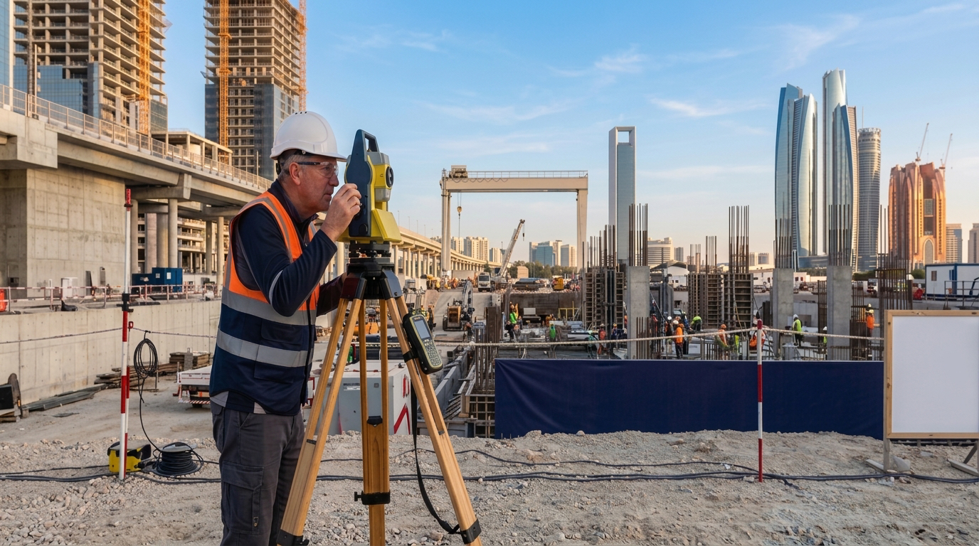
Even minor surveying errors can cascade into significant project delays, cost overruns, and structural failures, which is why accurate survey work forms such a critical foundation for every development. Professional construction survey companies in Abu Dhabi shape every phase of a project, from initial site assessment through to final handover, by delivering the precise measurements and reliable data that informed decisions depend on. This blog explores the most common surveying errors encountered on construction sites, explains why they happen, and offers practical solutions to keep your project running on schedule and within budget.
Key Takeaways
- Outdated survey data, incorrect benchmarks, and poor equipment calibration are among the top causes of construction delays linked to surveying errors.
- Partnering with experienced survey professionals reduces risk, improves accuracy, and ensures compliance with project specifications.
- Services such as demarcation survey services in Abu Dhabi, geographic survey in Abu Dhabi, and profile levelling survey work are critical checkpoints that prevent costly rework.
Why Surveying Errors Are So Costly in Construction
A single surveying mistake can invalidate weeks of construction work. According to the Institution of Civil Engineers, inaccurate site data is one of the leading contributors to project delays and budget overruns in infrastructure development. When measurements are wrong, structures are misaligned, utilities clash, and legal disputes over boundary encroachment become unavoidable.
The financial impact goes beyond rework. Incorrect surveys delay permit approvals, disrupt contractor schedules, and erode client trust. For large-scale developments, these compounding effects can push project timelines back by months. This is why selecting a reliable survey partner is not just a technical decision but a strategic one that affects every aspect of project delivery. Teams that invest early in survey grade mapping gain a measurable advantage in managing site complexity from the outset.
Error 1: Using Outdated Survey Data
Relying on old survey data is one of the most preventable yet frequently made mistakes in construction. Land conditions change due to erosion, previous excavation, groundwater shifts, and urban development. A survey conducted even one or two years ago may not reflect current site conditions accurately.
When project managers or engineers use outdated topographic or boundary data, they make design decisions based on ground realities that no longer exist. This often results in foundation issues, drainage miscalculations, and structural misalignments. Commissioning a fresh geographic survey in Abu Dhabi before any design work begins ensures the data reflects actual current conditions. The value of an up-to-date GIS services platform becomes especially clear when layering spatial data for complex sites where terrain and infrastructure have changed significantly. Always arrange a new survey at the project initiation stage, especially for complex or large-scale developments.
Error 2: Incorrect Benchmark and Reference Point Setup
Benchmarks are fixed reference points used to determine elevation and position across a construction site. If the initial benchmark is incorrectly established or poorly documented, every subsequent measurement taken from it will carry the same error. This is sometimes called a ‘systematic error’ because it compounds through every phase of construction.
A misplaced benchmark can cause floors to be built at wrong elevations, drainage systems to slope in incorrect directions, and structural elements to fail alignment checks. Qualified survey professionals establish and verify benchmarks through multiple cross-checks and use precise levelling instruments to confirm accuracy. Any reputable land surveying company in Abu Dhabi ensures vertical reference data is reliable from day one, reducing the risk of elevation-related construction failures. Accurate benchmark setup is also foundational to the success of establishing gridlines and datum across the site, which all subsequent construction activities depend upon.
Error 3: Poor Equipment Calibration and Maintenance
Surveying instruments such as total stations, GPS receivers, and digital levels must be regularly calibrated to maintain measurement accuracy. Even small calibration drift can result in positional errors of several centimetres, which is unacceptable in precision construction work. Unfortunately, equipment calibration is often overlooked when teams are under schedule pressure.
An uncalibrated total station can produce angular errors that translate into significant positional inaccuracies over long distances. Reputable survey professionals follow strict equipment maintenance protocols and schedule calibration checks before every major survey campaign. Field crews should also perform daily instrument checks, and any discrepancies should be reported and resolved before data collection begins. The most dependable construction survey companies in Abu Dhabi treat proper equipment care as a non-negotiable element of accurate survey delivery. Engaging a team experienced in terrestrial scanning can also bring additional precision to complex site environments where traditional instruments face limitations.
Error 4: Communication Gaps Between Survey Teams and Project Stakeholders
Surveying data is only useful when it reaches the right people in the right format at the right time. Communication breakdowns between survey crews, engineers, architects, and project managers lead to misinterpreted data, incorrect implementations, and duplicated effort. This is a common but under-discussed source of construction delay.
For example, a survey team may identify a level difference during a demarcation survey services in Abu Dhabi engagement, but if that information is not clearly communicated to the civil design team, the layout drawings may proceed with the incorrect assumption. Structured reporting protocols, regular site coordination meetings, and digital data sharing platforms help bridge these gaps. Experienced survey teams embed clear communication workflows into their service delivery to ensure all stakeholders have timely access to accurate survey outputs.
Error 5: Skipping Verification and Quality Control Steps
In fast-moving construction environments, there is often pressure to proceed quickly. Survey quality control steps such as repeat measurements, independent checks, and comparison against control networks are sometimes skipped to save time. This is a false economy that almost always results in more time lost through rework.
A robust quality assurance process includes comparing field measurements against known control points, reviewing data for statistical outliers, and conducting independent verification by a second surveyor. Providers of geographic survey in Abu Dhabi services typically follow international quality standards to ensure every dataset is verified before being used for design or construction purposes. Skipping these steps introduces risk that no project schedule can absorb without consequence. Thorough verification is equally essential when commissioning a profile levelling survey, where even minor elevation discrepancies can compound into serious drainage or structural issues.
How Construction Survey Companies in Abu Dhabi Help Avoid These Errors
Selecting the right survey team is one of the most impactful decisions a construction project manager can make. The best construction survey companies in Abu Dhabi distinguish themselves not only through technical capability but through the depth of their quality management and communication practices. Look for companies that demonstrate the following qualities when evaluating potential partners.
- Proven experience in construction surveys and infrastructure projects in the region.
- Use of modern, calibrated surveying instruments and software.
- Clear project communication protocols and structured reporting.
- Capability to deliver services including profile levelling survey work, boundary demarcation, and topographic mapping.
- A quality management process that includes verification and independent checking.
According to the International Federation of Surveyors, projects that engage professionally qualified surveyors from the earliest planning stages consistently achieve better accuracy outcomes and fewer costly redesigns. A trusted land surveying company in Abu Dhabi adds measurable value not just through data collection but through the expertise applied to interpreting and communicating that data effectively. The ability to deliver reliable as-built surveys at project completion is another indicator of a survey partner who maintains quality standards throughout the entire construction lifecycle.
The Role of Demarcation and Levelling Surveys in Preventing Errors
Two survey types deserve special mention when discussing error prevention. Demarcation surveys establish legal and physical boundaries of a parcel of land, ensuring construction stays within approved limits. Without proper demarcation survey services in Abu Dhabi, projects risk encroachment onto adjacent properties, leading to legal disputes and mandatory demolition of completed structures.
Profile levelling surveys establish accurate elevation profiles across a site, which are essential for designing roads, drainage systems, and building foundations. A professional profile levelling survey company in Abu Dhabi provides the vertical data that prevents drainage failures, uneven floor slabs, and costly earthwork miscalculations. Together, these two survey types form a critical baseline that protects every subsequent phase of construction from positional and elevation errors. The data captured during these surveys also supports downstream services such as data processing, ensuring information is refined and ready for use across design and construction teams.
Conclusion
Surveying errors are preventable. The common mistakes discussed here, including outdated data, incorrect benchmarks, poor equipment calibration, and communication failures, each have clear, practical solutions. Working with an experienced land surveying company in Abu Dhabi ensures your project benefits from accurate data, professional verification, and structured communication from the ground up. Reach out to the Global Map Survey team through our services page to ensure your next project starts on solid, accurately measured ground.
FAQ
Q1: What are the most common surveying errors that delay construction projects?
Answer: The most common errors include using outdated survey data, setting incorrect benchmarks, failing to calibrate equipment, and poor communication between teams. Each of these mistakes can cause misalignments, rework, and significant schedule delays on construction sites in Abu Dhabi.
Q2: How do construction survey companies in Abu Dhabi prevent benchmark errors?
Answer: Professional survey companies cross-check benchmarks using multiple reference points and calibrated levelling instruments. Independent verification by a second surveyor is also standard practice. These steps confirm that all elevation and positional data is consistent before construction activities begin.
Q3: Why is a geographic survey in Abu Dhabi necessary before starting construction?
Answer: A geographic survey in Abu Dhabi captures current ground conditions, topography, and spatial features that directly inform design decisions. Using current data helps engineers and architects avoid costly errors caused by assuming site conditions that may have changed since any previous survey was conducted.
Q4: What is a profile levelling survey and when is it needed?
Answer: A profile levelling survey measures elevation changes along a specific line or across a site. It is essential for road design, drainage planning, and foundation work. Engaging a qualified profile levelling survey company in Abu Dhabi ensures accurate vertical data that prevents expensive earthwork and drainage failures throughout the project.
Q5: How often should construction survey equipment be calibrated?
Answer: Surveying equipment should be calibrated according to manufacturer specifications and before every major survey campaign. Field teams should also perform daily instrument checks. Regular calibration prevents measurement drift that can introduce positional errors, particularly over long distances where even small angular inaccuracies become significant.
Q6: What role do demarcation survey services play in avoiding legal disputes?
Answer: Demarcation survey services establish the precise legal and physical boundaries of a land parcel. This prevents construction from accidentally encroaching onto neighbouring properties. Without proper demarcation, projects risk boundary disputes, mandatory demolition orders, and significant legal costs that could have been avoided with accurate boundary data from the outset.
Q7: How can communication gaps in survey teams be addressed effectively?
Answer: Structured reporting protocols, regular site coordination meetings, and digital data sharing platforms help reduce communication gaps. Experienced survey teams embed clear handover procedures so engineers, architects, and project managers all receive timely, accurately formatted survey data needed for their specific roles in the construction process.
Q8: Can outdated topographic data really cause structural problems in construction?
Answer: Yes. Outdated topographic data can lead to foundation designs that do not match actual ground conditions, drainage systems that slope incorrectly, and structural misalignments. Commissioning a current survey from a qualified survey contracting and consultancy team before design work begins is the most reliable way to prevent these data-driven structural problems.
Q9: What quality control steps should a land surveying company in Abu Dhabi follow?
Answer: A reliable survey company should include repeat measurements, comparison against established control networks, statistical review of field data, and independent verification checks. These steps confirm data integrity before it is used for engineering design or construction layout, significantly reducing the risk of costly rework on any project.
Q10: How does professional surveying support faster construction project delivery?
Answer: Accurate survey data reduces the need for rework, prevents permit delays, and gives design teams reliable information for decision-making. Teams supported by professional monitoring services throughout a project can maintain schedules and avoid the costly disruptions caused by data errors discovered mid-construction.
AN ISO 9001-2015 CERTIFIED COMPANY