Home \ Blog \ Hydrographic Survey Services in UAE: A Complete Guide
Hydrographic Survey Services in UAE: A Complete Guide
May 21, 2026
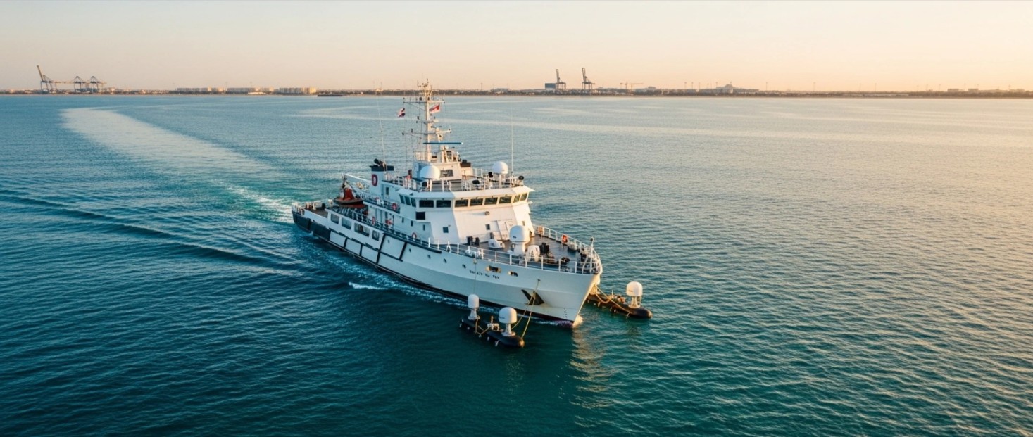
Hydrographic survey services in UAE are central to the country’s ongoing coastal and marine infrastructure growth. From major port expansions to offshore energy installations, accurate underwater data shapes every critical decision. This guide explains what hydrographic surveys involve, why they are vital in the UAE, and what leading providers deliver on the ground. Whether you are a civil engineer, construction contractor, or project planner, this blog gives you the knowledge to make informed choices about marine survey solutions across the region.
Key Takeaways
- Hydrographic surveys map underwater terrain, water depths, and seabed conditions that are critical to UAE marine and coastal projects.
- Leading hydrographic survey companies in UAE offer services ranging from bathymetric mapping and dredging support to tidal observation and offshore positioning.
- Hydrographic survey services in Abu Dhabi are integral to port development, coastal engineering, and offshore infrastructure planning.
What Are Hydrographic Survey Services and Why Do They Matter?
Hydrographic surveys provide precise underwater data that supports safe navigation, coastal planning, and marine infrastructure development across the region.
The UAE sits at the crossroads of global maritime trade, with some of the world’s most active shipping lanes running through its territorial waters. Hydrographic survey services collect detailed measurements of water depths, seabed composition, underwater obstructions, and tidal patterns. Engineers, port authorities, and developers use this data to plan construction, manage dredging operations, and maintain navigational safety. Without reliable hydrographic data, marine projects face higher risks of costly delays, structural failures, and safety incidents. The International Hydrographic Organization sets the global standards that govern how these surveys are conducted and how results are reported across the industry.
Core Components of Hydrographic Survey Services in UAE
Modern hydrographic surveys in UAE combine advanced sonar, precision positioning, and data processing technologies to deliver comprehensive underwater intelligence.
A full hydrographic survey brings together several specialized activities that work in coordination. Multibeam and singlebeam bathymetric surveys measure water depths across broad project areas, producing highly detailed seabed maps that guide engineering design. Side scan SONAR surveys and mosaicing detect underwater features, debris, and hazards while generating visual mosaics of the seabed surface. Tidal observation ensures that all depth readings are corrected to a consistent vertical datum, improving overall accuracy. Together, these components give project teams a complete picture of the underwater environment before construction or dredging operations begin.
How Hydrographic Survey Companies in UAE Support Major Projects
Hydrographic survey companies in UAE provide the critical underwater data that drives port development, offshore energy, dredging, and coastal protection projects at every stage.
The UAE hosts world-class port facilities, active offshore oil and gas platforms, and large-scale coastal development programmes. Hydrographic survey companies in UAE support these initiatives from initial assessment through to completion. Pre and post dredging bathymetric services allow contractors to verify dredged volumes and confirm that navigational channels meet required depth specifications. Offshore positioning services ensure that subsea structures, cables, and equipment are placed with precision in open water environments. Hydrographic data also supports environmental monitoring programmes, helping authorities track shifts in coastal sediment and assess development impacts on marine ecosystems.
Hydrographic Survey Services in Abu Dhabi: Key Applications
Hydrographic survey services in Abu Dhabi support the emirate’s expanding portfolio of coastal infrastructure, marine energy, and port development projects.
Abu Dhabi is a regional hub for coastal and offshore development activity. Hydrographic survey services in Abu Dhabi are applied across a wide range of project types. Port and marina expansions depend on precise depth charts and detailed seabed assessments to guide safe dredging and construction. Offshore oil and gas installations require accurate seabed stability data and positioning information to ensure structural integrity. Coastal protection schemes rely on beach profiling and sediment analysis to design breakwaters and revetments that perform effectively over time. Global Map Survey’s marine survey services in Abu Dhabi cover all these applications, giving project teams the data confidence they need at every phase.
How to Choose the Right Hydrographic Survey Partner in UAE
Selecting the right hydrographic survey provider in UAE depends on technical capability, equipment standards, local project experience, and the quality of data delivery.
Not all hydrographic survey companies in UAE offer the same breadth or depth of service. When evaluating providers, assess their range of survey technologies, including multibeam sonar systems, ADCP current meters, and sub-bottom profilers. Look for companies with a documented track record on UAE and regional projects and a clear understanding of local regulatory and reporting requirements. Data quality matters as much as fieldwork accuracy. A strong provider delivers processed, corrected datasets in formats compatible with your engineering and GIS software platforms. Clear project management, responsive communication, and on-time reporting further reduce project risk and keep programmes running to schedule. You can also review the NOAA hydrographic survey guidelines to understand international benchmarks for data quality and deliverables.
Conclusion
Hydrographic survey services in UAE form the foundation of safe, well-planned marine and coastal infrastructure development. From bathymetric mapping and dredging support to tidal observation and offshore positioning, these services deliver the underwater intelligence that engineers and project teams depend on. As the UAE continues to develop its ports, coastlines, and offshore facilities, demand for skilled hydrographic survey companies in UAE will keep growing. Choosing an experienced partner ensures your project benefits from accurate data, advanced field technologies, and professional expertise from start to finish. Contact Global Map Survey today to find out how our marine survey services can support your next project across the UAE and Abu Dhabi.
FAQ
Q1: What are hydrographic survey services?
Answer: Hydrographic survey services are specialist measurements of underwater environments, including water depths, seabed features, and tidal conditions. They provide the spatial data needed to support port construction, dredging, offshore development, and safe marine navigation.
Q2: Why are hydrographic surveys important in the UAE?
Answer: The UAE’s extensive coastline, busy shipping lanes, and major port infrastructure make accurate underwater data essential. Hydrographic surveys reduce project risk, ensure navigational safety, and support the planning of coastal and offshore developments across the region.
Q3: What is bathymetric mapping in hydrographic surveys?
Answer: Bathymetric mapping measures and charts water depths across a survey area using sonar technology. Multibeam and singlebeam bathymetric surveys are commonly used in dredging design, port planning, and marine construction projects across the UAE.
Q4: How do hydrographic surveys support dredging projects?
Answer: Hydrographic surveys conducted before and after dredging verify excavated volumes and confirm that channels reach specified depths. This data ensures contractors meet project requirements and helps authorities confirm navigational clearance before vessels begin using the route.
Q5: What technologies do hydrographic survey companies in UAE use?
Answer: Leading hydrographic survey companies in UAE use multibeam echo sounders, side scan sonar, sub-bottom profilers, and high-precision GNSS positioning. ADCP and current meter observations are also widely used to measure water flow and current patterns in coastal and offshore environments.
Q6: What are hydrographic survey services in Abu Dhabi used for?
Answer: In Abu Dhabi, hydrographic surveys support port expansions, offshore energy platforms, coastal protection projects, and marina developments. They provide the seabed and water depth data that engineers and planners need to design and deliver marine infrastructure safely.
Q7: How long does a hydrographic survey take?
Answer: Survey duration depends on the project area, water conditions, and data requirements. Small harbour surveys may take a few days, while large offshore or coastal surveys can run for several weeks. Proper planning and specialist equipment help keep timelines efficient.
Q8: What is the difference between a hydrographic and a topographic survey?
Answer: A topographic survey maps above-ground terrain, while a hydrographic survey maps underwater environments including depths, seabed features, and water conditions. Both are vital for coastal construction projects but require different equipment, methods, and specialist expertise.
Q9: Are hydrographic surveys required for port construction in the UAE?
Answer: Yes. Port construction and dredging projects in the UAE typically require hydrographic surveys to meet regulatory, safety, and engineering standards. Sea bed sampling is often conducted alongside bathymetric surveys to assess sediment composition and support geotechnical planning decisions.
Q10: How do I choose a reliable hydrographic survey company in the UAE?
Answer: Look for companies with proven experience on UAE marine projects, certified equipment, and strong data processing capabilities. Assess their reporting standards, turnaround times, and familiarity with local regulatory requirements to ensure your project receives accurate and compliant survey data.
AN ISO 9001-2015 CERTIFIED COMPANY