
Home \ Blog \ Offshore Site Investigation in Abu Dhabi: Survey Scope
Offshore Site Investigation in Abu Dhabi: Survey Scope
September 16, 2026
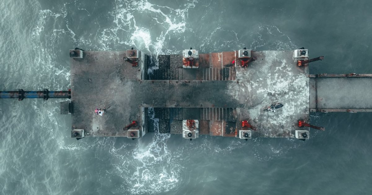
An offshore site investigation in Abu Dhabi usually goes wrong in the same way. The geotechnical programme is mobilised before the geophysics, boreholes land in the wrong place, and the campaign returns to sea at full day rate to fill the gaps. Ground investigation sequencing is the whole discipline. This article sets out the order in which marine survey stages should run for a jetty, quay, outfall, cable landing or offshore structure, what each stage is actually there to answer, and how to write a scope that gets the answers in one mobilisation.
Key Takeaways
- Geophysics before geotechnics. Survey the whole footprint first, then place boreholes where the survey says the ground changes rather than on a convenient grid.
- Every stage shares one positioning framework and one datum. Campaigns that let each contractor bring their own spend the interpretation phase reconciling coordinates.
- The deliverable is a ground model, not a stack of reports. Specify the model and the format it must arrive in before anyone mobilises.
The Sequence That Works
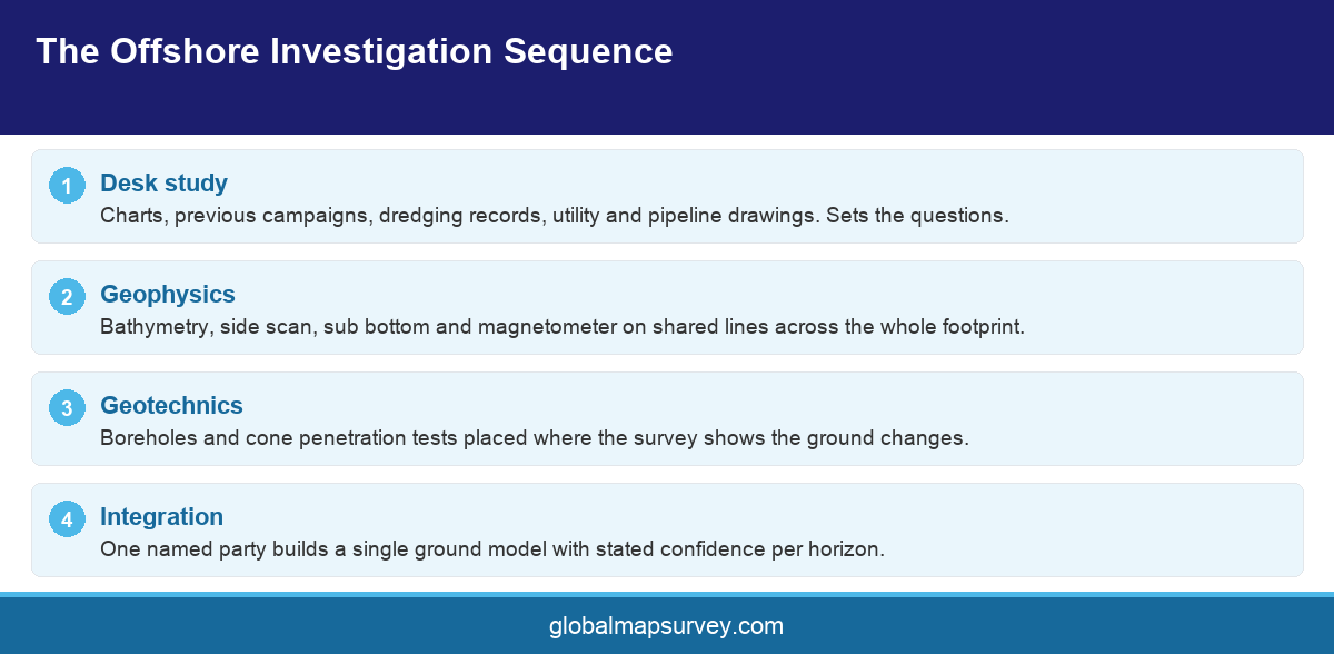
A marine investigation has a natural order, and departing from it costs money. First comes a desk study, which is cheap and routinely skipped. Existing charts, previous campaigns, dredging records, utility and pipeline drawings and admiralty publications establish what is already known and, more importantly, what is suspected. That study sets the questions the field work has to answer.
Second comes geophysics. Bathymetry establishes the seabed surface, side scan images what lies on it, sub bottom profiling maps the layering beneath, and magnetometry finds buried ferrous material. Acquired together on shared lines, these four build a continuous picture across the whole footprint for a fraction of what point sampling would cost.
Third comes geotechnics. Boreholes, cone penetration tests and sampling are placed where the geophysics indicates the ground changes, at the structure locations, and at points chosen to calibrate the geophysical horizons. This is the expensive stage, which is exactly why it should be the informed one.
Skipping straight to boreholes is the classic error, and it is easy to understand why it happens. The geotechnical scope is the one the structural designer asks for by name, it has a familiar deliverable, and it feels like the real investigation. The problem is that a borehole describes a cylinder a few hundred millimetres across. Everything between boreholes is inferred, and on a site with variable carbonate cementation or a buried channel the inference can be badly wrong. Geophysics first is not a preliminary. It is what makes the geotechnical spend defensible.
Fourth comes integration. Somebody has to sit with the geophysical sections and the borehole logs and produce a single ground model with stated confidence. If that person is not appointed at the start, the integration tends not to happen, and the design team is left to reconcile two datasets that were never tied together.
What Each Stage Is Actually For
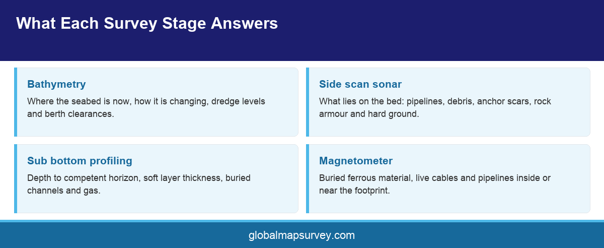
Bathymetry answers where the seabed is now and how it is changing. For a jetty or quay it sets dredge levels and berth clearances. For a cable or pipeline it sets the route profile. Repeat surveys against an earlier epoch reveal scour and accretion, which is often the finding that changes a design.
Side scan answers what is on the bed. Existing pipelines, debris, anchor scars, rock armour extents and hard ground all affect where a structure can go and how it can be built. The imagery also finds the obstructions that would otherwise be found by a jack up leg.
Sub bottom answers what is underneath. Depth to a competent horizon, thickness of soft material, presence of buried channels and gas blanking are all direct inputs to foundation type and dredge method. This is the stage that most often changes the design concept rather than refining it.
Magnetometry answers what is buried and ferrous. Live pipelines and cables inside or near the footprint are the obvious concern, and the consequence of hitting one during piling is severe enough that most asset owners in the Emirates make the survey a condition of approval.
Geotechnics then answers the questions the acoustic methods cannot. Strength, density, plasticity, carbonate content and cyclic behaviour are properties of the material rather than of its acoustic contrast, and they are what a foundation is actually designed against. The geophysics tells the engineer where each material sits and how far it extends. The boreholes tell them what it is and how it will behave under load.
Positioning, Datum and the Reconciliation Trap
A marine campaign generates data from several vessels, several sensors and often several contractors. Unless one positioning framework is imposed at the outset, the integration phase becomes a coordinate reconciliation exercise, and reconciliation after the fact is slow, expensive and error prone.
Fix one horizontal reference system with a named transformation, and one vertical datum with a documented relationship to both chart datum and the land datum the structure will be built to. State both in the scope, require every deliverable to carry them, and require any contractor working on another system to deliver in yours as well as their own.
Vessel offsets deserve the same rigour. The distance from the positioning antenna to the transducer, to the towpoint and to the drill string has to be measured and recorded, not estimated. An unrecorded offset shifts an entire dataset by a fixed amount that is very hard to detect later.
For structures, offshore positioning during installation should be planned in the same framework as the investigation. A campaign that establishes the ground model on one system and then positions the piles on another has created a discrepancy at the worst possible moment.
Writing the Scope
Start with the decisions the investigation must support, then work backwards to the data those decisions need. A jetty on piled foundations needs depth to a bearing layer, driveability information and obstruction clearance along the pile lines. An outfall needs a route profile, burial feasibility and crossing information. Those are different campaigns even at the same site.
Define the footprint generously. Investigation limited exactly to the structure outline leaves no information for the temporary works, the barge moorings, the anchor spread or a design change that shifts the structure twenty metres. Extending the survey area is cheap during mobilisation and expensive afterwards.
Specify the ground model as a deliverable in its own right, with named horizons, stated confidence and a format the design team can load. Also specify who owns the integration, because that role is the one most often left unassigned.
Sequence the procurement to match the technical sequence. A single contract covering geophysics, geotechnics and integration removes the interface risk entirely, but it is not always available or commercially preferable. Where the packages are split, award the geophysics first with an option to extend, and hold the geotechnical scope open until the survey results are in. Awarding both at the same time on a fixed borehole schedule locks in the positions before anyone knows where they should be, which reintroduces exactly the problem the sequence was meant to solve.
Build weather contingency into the programme rather than the budget alone. Working windows in the Gulf are affected by shamal conditions and summer sea state, and a campaign priced with no standby allowance will either overrun or cut scope. Agree in advance which scope items are protected if time is lost, so the cut is a decision rather than a default.
Conclusion
An offshore site investigation in Abu Dhabi is a sequence, and the sequence is the value. Do the desk study, run the geophysics across the whole footprint, then place the expensive geotechnical points where the survey says the ground changes. Hold everything on one positioning framework and one datum, name the person responsible for integrating it, and specify the ground model as the deliverable. To scope a marine investigation campaign for a project in Abu Dhabi or the wider Gulf, talk to the Global Maps Survey marine team.
AN ISO 9001-2015 CERTIFIED COMPANY