
Home \ Blog \ Side Scan Sonar Survey in UAE: Imaging the Seabed Surface
Side Scan Sonar Survey in UAE: Imaging the Seabed Surface
September 11, 2026
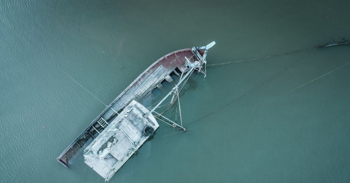
A Global Map Survey’s side scan SONAR surveys and mosaicing page produces something closer to an aerial photograph of the seabed than to a depth chart. It shows texture, debris, scour, exposed pipelines and anything else sitting proud of the bed, across a wide swath either side of the tow path. This article covers what the imagery can and cannot resolve, how range and frequency trade against each other, why mosaic quality depends more on navigation than on the sonar, and how to specify a survey that will actually find what you are looking for.
Key Takeaways
- Side scan images the seabed surface and what lies on it. It does not measure depth reliably and it does not see below the bed, so it is almost always run alongside another method.
- Detection depends on shadow. An object is recognised by the acoustic shadow it casts, which is why survey lines are planned so that targets are seen from more than one direction.
- Mosaic quality is a navigation problem. Position the towfish accurately or the image will be sharp and in the wrong place.
What the Imagery Shows
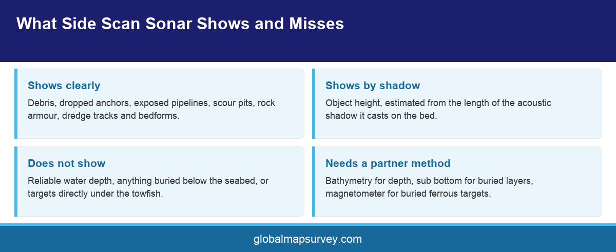
A side scan sonar towfish emits fan shaped pulses to port and starboard and records the strength of the return from the seabed. Hard, rough or upstanding material reflects strongly and appears bright. Soft mud returns weakly and appears dark. Behind any object that stands above the bed there is an acoustic shadow where no energy reached, and that shadow is the most informative part of the record.
Shadow length is what lets an interpreter estimate the height of a target from an image that carries no depth information. A short shadow means a low object. A long shadow at the same range means a taller one. Because shadow depends on the geometry between the fish and the target, a target directly beneath the tow path casts almost no shadow at all, which is why the nadir strip under the fish is effectively a blind zone and why adjacent lines must overlap across it.
Typical findings on a Gulf survey include dropped anchors and chain, discarded fishing gear, construction debris, exposed or spanning pipeline sections, scour pits around piles and quay walls, dredge tracks, rock armour extents and bedform patterns that indicate the direction and strength of sediment transport.
What side scan does not give is reliable depth. The imagery is a measure of backscatter, not of range to the bed in a form that supports volumes. Any project needing both texture and depth pairs the sonar with a bathymetric survey rather than trying to derive one from the other.
Range, Frequency and the Detection Question
Sonar range and resolution pull against each other. A lower frequency reaches further from the tow path and covers ground quickly, but the detail degrades. A higher frequency resolves small targets crisply over a much narrower swath. Dual frequency systems record both simultaneously, which is usually the sensible default.
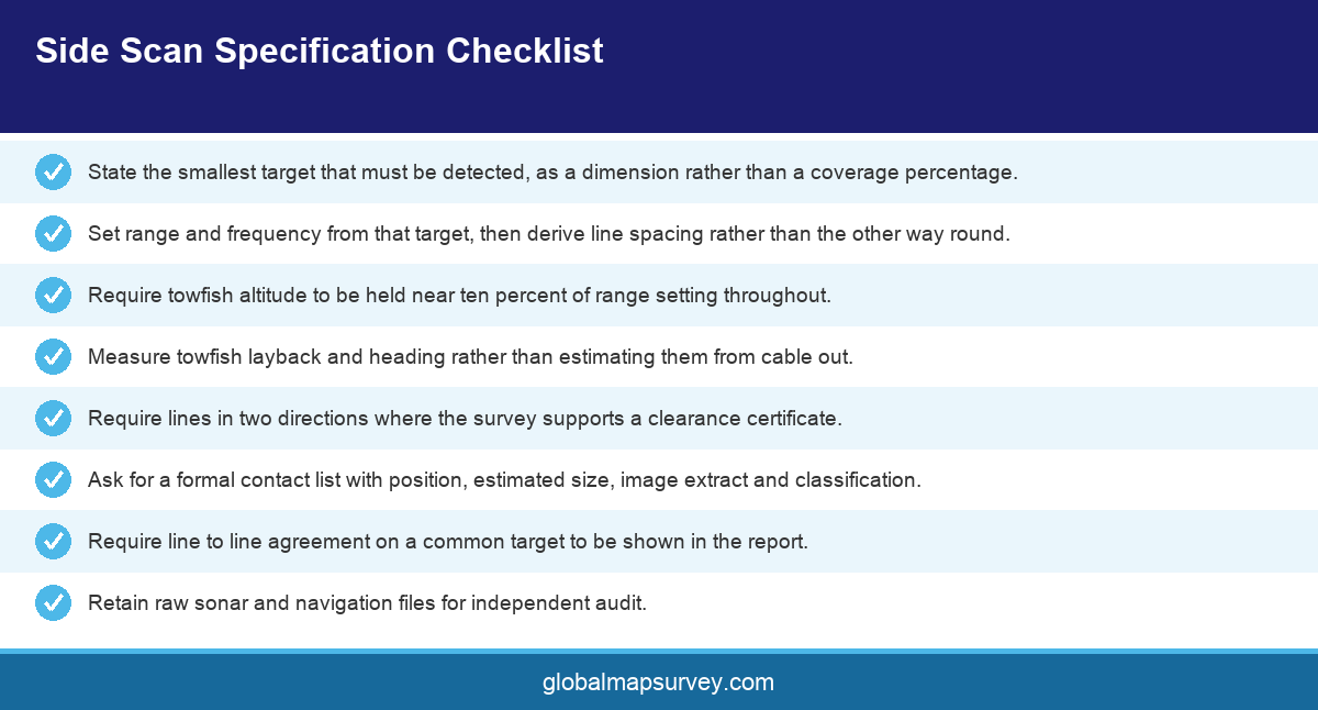
Range setting then determines line spacing. Run wide and you cover the area in fewer passes, but the outer swath resolution is poor and the nadir gaps are larger. Run narrow and detection improves across the whole swath at the cost of more line kilometres. The right setting depends entirely on the smallest target that matters, which is a number the client has to supply.
That number should be explicit in the scope. A survey specified to detect a one metre object is a different job from one specified to detect a two hundred millimetre object, and quoting without it guarantees a mismatch. International practice expresses this as a detection requirement rather than a coverage percentage, and the specification should follow suit.
Bottom type changes what detection means in practice. Over flat, soft mud a small hard object stands out sharply because the background return is weak and uniform. Over rippled sand, rock armour or coral the background is already bright and broken, and a similar object can disappear into it entirely. Survey planning in the Emirates has to account for that, because a single project can run from soft basin mud into rippled sand and onto rock within a few hundred metres. Where the seabed changes character, the detection capability changes with it, and an honest report says where.
Towfish altitude is the practical control. The fish should fly at roughly ten percent of the range setting above the bed. Too high and shadows shorten until small targets vanish. Too low and the outer swath is lost. In the shallow water typical of Gulf berths and channels, holding a sensible altitude is genuinely difficult and is a fair test of a crew.
Why Mosaics Go Wrong
A mosaic is the assembled image of all the swaths, geo referenced into one continuous picture. When mosaics disappoint, the sonar is rarely at fault. The usual cause is towfish position.
The fish is behind and below the vessel on a cable, so its position is not the vessel position. Layback has to be computed or, better, measured with an acoustic positioning system. Estimating it from cable out and assumed catenary introduces an along track error that shows up immediately as features that do not line up between adjacent lines.
Heading is the second offender. A towfish yaws behind the vessel, particularly in a cross current, and an uncorrected yaw skews every swath. Systems that measure fish heading directly remove that error, and surveys that assume vessel heading applies to the fish do not.
The test of a mosaic is simple and should be in the report. Take a distinctive target visible on two adjacent lines and show how far apart it plots. If the answer is inside the stated tolerance, the navigation is sound. If the report does not contain that comparison, the survey data processing has not been demonstrated.
Specifying a Survey That Finds Things
State the minimum target size and the required confidence of detection. State whether contacts must be seen from two directions, which in practice doubles the line plan but removes most false negatives. State whether contacts are to be relocated and inspected, and by whom.
Ask for a contact list as a formal deliverable, with position, dimensions estimated from shadow, an image extract and a classification with confidence for every item. A mosaic on its own puts the interpretation burden on the client.
Decide what happens to a contact once it is found, and write that into the scope as well. Some projects want every contact relocated and confirmed. Others only care about targets above a size threshold or inside a defined footprint. Leaving it open means the surveyor either over delivers at their own cost or under delivers against an expectation nobody wrote down, and both outcomes produce a difficult conversation at handover.
Plan the interpretation time as carefully as the field time. Reviewing a full survey line by line at a scale where small targets remain visible takes considerably longer than acquiring it, and the temptation on a compressed programme is to review the mosaic instead of the raw records. That is where targets get missed, because mosaicking resamples the imagery and small contacts are exactly the detail that resampling removes. Contacts should be picked from the raw waterfall records and then confirmed on the mosaic, never the other way round.
For clearance work, agree in advance what a clean result means and how it will be evidenced. Offshore positioning records and the raw sonar files should be retained, because a clearance certificate is only as strong as the data an auditor can go back to.
Conclusion
A side scan sonar survey in UAE is a detection tool, and detection is engineered rather than hoped for. Fix the smallest target that matters, set range and frequency to suit it, fly the fish at a sensible altitude, and position it properly rather than assuming it sits under the vessel. Ask for a contact list rather than a picture, and for the line to line agreement that proves the mosaic. To plan a seabed imaging or obstruction clearance survey in the Emirates, contact the Global Maps Survey marine team.
AN ISO 9001-2015 CERTIFIED COMPANY