
Home \ Blog \ Magnetometer Surveys in UAE: Finding Buried Ferrous Targets
Magnetometer Surveys in UAE: Finding Buried Ferrous Targets
September 14, 2026
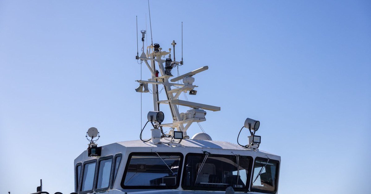
Sonar sees what sits on the seabed. It cannot see a pipeline buried under two metres of sand or a shell that settled into the mud decades ago. A Global Map Survey’s magnetron meter survey page finds those targets by measuring distortions in the earth magnetic field caused by ferrous material, whether that material is exposed, buried or sitting inside a trench. This article explains how the method works, what line spacing and sensor altitude actually control, how anomalies become targets, and how to specify a survey that will stand up when someone has to certify a corridor as clear.
Key Takeaways
- A magnetometer detects ferrous mass, not shape. It will find a buried pipeline or a discarded anchor, and it will ignore a concrete block or a plastic duct entirely.
- Detection is governed by distance. Halving the sensor to target separation increases the signal enormously, which makes sensor altitude and line spacing the two decisions that matter most.
- The client must state the smallest target that matters. Without that number, no survey design can be justified and no clearance statement means anything.
What the Method Measures
The earth generates a magnetic field that is smooth and predictable over open ground. Any concentration of ferrous material distorts it locally, producing a magnetic anomaly that a sensitive sensor can measure as a departure from the background. A magnetometer records total field strength continuously along a survey line, and the anomalies stand out against that background once the natural variation has been removed.
That last step is not optional. The earth field varies through the day, and magnetic storms can move it by more than the anomaly you are hunting. A base station recording at a fixed point on shore lets the diurnal variation be subtracted from the survey record. Surveys run without base station correction produce apparent anomalies that are simply the sun.
Marine work usually tows the sensor astern of the vessel, far enough back that the steel hull and its engines do not swamp the reading. Gradiometer arrangements, which measure the difference between two sensors a fixed distance apart, cancel most of the regional field automatically and sharpen the response to nearby targets. They cost more to deploy and they repay it on cluttered ground.
What the instrument cannot do is identify. It reports that ferrous mass is present at an approximate location with an approximate magnitude. Whether that mass is a pipeline, a mooring chain, a length of scaffold or an ordnance item is an interpretation supported by shape, context and, where the answer matters, by physical investigation.
Line Spacing, Altitude and What They Really Control
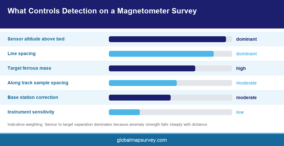
Magnetic anomaly strength falls extremely rapidly with distance from the target. The practical consequence is that a sensor flown or towed close to the bed detects far smaller objects than the same sensor two metres higher, and no amount of processing recovers what was never sensed.
Line spacing follows directly. A target must be passed closely enough for its anomaly to rise above the background noise, so the spacing has to be derived from the smallest target of interest and the expected burial depth. Spacing chosen for convenience rather than from that calculation is the most common reason a survey misses things it was paid to find.
Sensor altitude control is the practical challenge. In shallow Gulf water with variable bed relief and strong tidal streams, holding a towed sensor at a consistent height above the bed takes active management, and the record should include the altitude achieved rather than the altitude intended. Where altitude cannot be held, the detection capability varies along the line, and the report should show where.
Ground conditions in the Emirates add one complication worth planning for. Coastal reclamation and port construction leave a great deal of ferrous debris behind, from cut off reinforcement and lost tools to abandoned mooring hardware. On a brownfield berth or an established anchorage the anomaly count can run into the hundreds, and a survey designed for a clean greenfield corridor will produce a target list nobody can act on. Where clutter is expected, gradiometer configurations and tighter line spacing earn their cost by separating targets that a single sensor would merge into one blur.
Speed matters too, though less obviously. Sampling rate and vessel speed together set the along track measurement interval, and a fast run with a slow sampling rate can step straight over a small anomaly between readings. Specifying an along track sample spacing rather than a vessel speed removes the ambiguity.
From Anomaly to Target
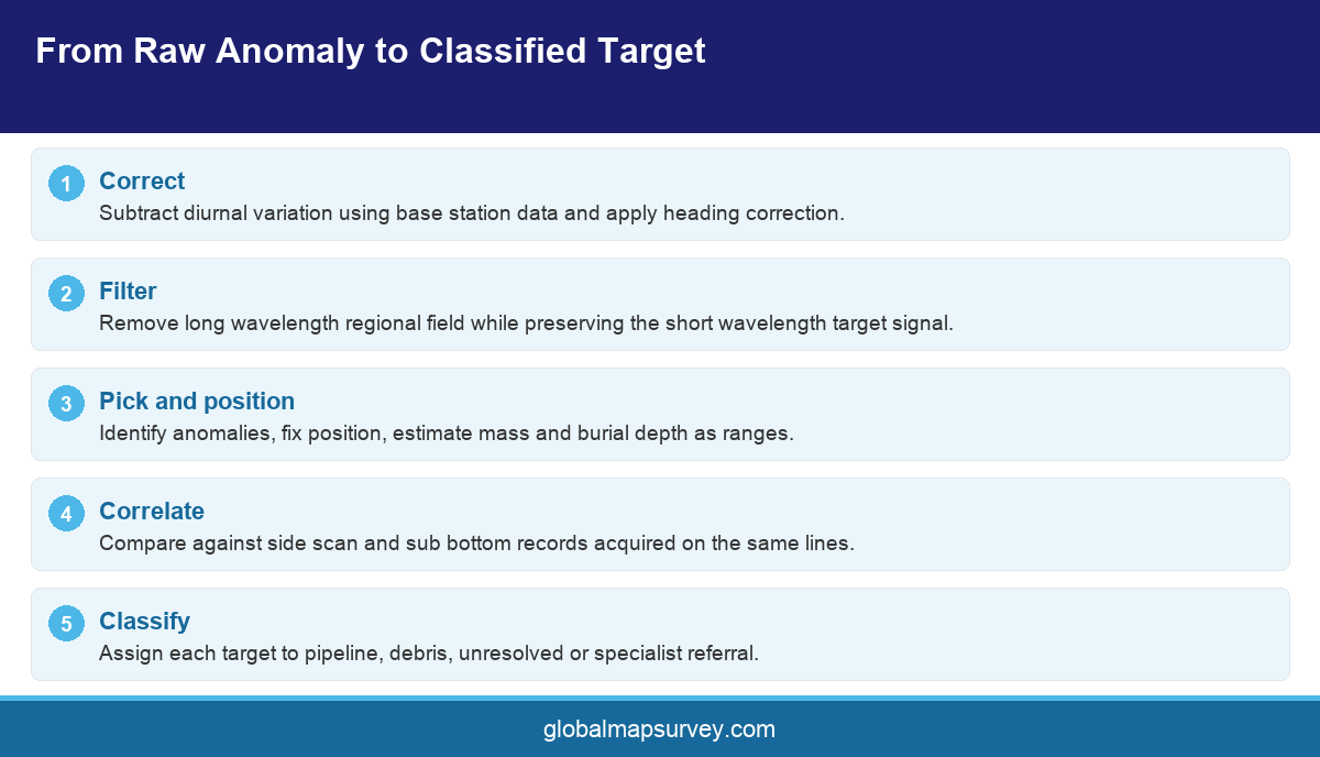
Processing starts with base station correction and heading correction, then a filter to remove long wavelength regional variation while preserving the short wavelength signal a compact target produces. Over correcting at this stage removes real anomalies, so the filter choice should be stated and its effect shown.
Anomalies are then picked, positioned and assigned an estimated mass and depth. Those estimates come from the shape and amplitude of the anomaly and are indicative rather than exact, which is why they should always be reported with a range. A single number implies a precision the physics does not support.
Classification is where survey judgement earns its fee. A long linear anomaly running consistently across multiple lines is almost certainly a pipeline or cable. A tight isolated anomaly of modest mass could be anything from a dropped shackle to something that requires a specialist response. Correlating the magnetic picture with side scan sonar imagery and sub bottom records from the same lines resolves a large share of these ambiguities before anyone gets wet.
Targets that remain unresolved and sit inside the works footprint go forward for investigation. That may mean diver inspection, a controlled excavation, or on a corridor with credible ordnance risk, referral to a specialist unexploded ordnance contractor. A survey report should say plainly which category each target falls into rather than presenting a uniform list.
Specifying a Survey That Can Be Certified
Clearance surveys carry a different burden from investigation surveys. If the output will be used to certify a corridor as clear before piling, dredging or trenching, the specification has to define the detection threshold, the survey geometry that delivers it, and the evidence required to show it was achieved.
State the minimum target mass and maximum burial depth to be detected. Require the line spacing calculation to be submitted and justified. Require sensor altitude to be logged and reported per line. Require base station data to be delivered alongside the survey record so the correction can be independently checked.
Ask for the raw and corrected data, not only the target list. A clearance certificate whose underlying data cannot be reprocessed is difficult to defend if a target is later found inside the area it covered. This is the same provenance argument that applies to any survey data processing deliverable, and it is sharper here because the consequence of a miss is physical.
One terminology note, because it causes confusion in tender documents across the region. The industry term is magnetometer survey. Some local documentation and service listings use magnetron meter survey, which is a transcription error for the same thing. If a scope uses that phrasing, it is asking for magnetometry, and it is worth correcting the wording before it propagates into drawings and certificates.
Conclusion
A magnetometer survey in UAE answers a question no other marine method can, which is what ferrous material lies buried beneath the seabed. The survey stands or falls on three decisions taken before mobilisation. Name the smallest target that matters, derive line spacing and sensor altitude from it rather than from convenience, and correct for diurnal variation with a base station. Then read the magnetic picture alongside sonar and sub bottom data before classifying anything. To scope a magnetometer or combined geophysical survey in the Emirates, contact Global Maps Survey.
AN ISO 9001-2015 CERTIFIED COMPANY