
Home \ Blog \ Dilapidation Survey Services in UAE: Protect Against Claims from Adjacent Works
Dilapidation Survey Services in UAE: Protect Against Claims from Adjacent Works
August 25, 2026
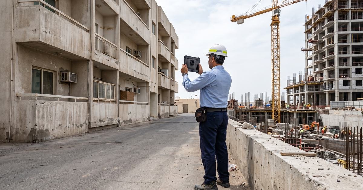
When a neighbouring owner claims your excavation cracked their building, the argument is decided by what was already there before you started. Dilapidation survey services in UAE produce that record. Done properly, the survey ends most claims quickly. Done as a quick photo walk, it produces a file that fails at exactly the moment it is needed. This guide covers what separates the two.
Key Takeaways
- A dilapidation survey is a legal evidence exercise recorded by survey methods, not a condition opinion.
- The record must be dated, complete and unambiguous about location, or it will not resolve a dispute.
- It should be paired with monitoring, because the survey proves what existed and monitoring proves what changed.
What the Survey Is Actually For
A dilapidation survey records the condition of a property before nearby work begins, so that any later claim can be tested against a dated baseline. It is sometimes called a pre condition survey or a schedule of condition, and its value lies entirely in being contemporaneous.
The purpose is narrow and worth stating plainly. The survey is not an assessment of whether the building is sound, nor an opinion on why existing defects are there. It records what is visible, where it is and how large it is, on a specific date, in a form that can be produced later without argument.
That narrowness is a strength. A record that only claims to document observable condition is very difficult to attack. A report that ventures into causes and opinions invites a competing expert view and turns a factual document into a contested one. Our dilapidation survey services are built around that distinction.
Keeping the scope factual also keeps it affordable. A survey that records observable condition can be delivered systematically by trained surveyors working to a defined method. A report that attempts diagnosis needs specialist structural input on every defect, which multiplies both cost and programme without strengthening the evidence in the way that matters.
Setting the Right Scope Before Anyone Attends
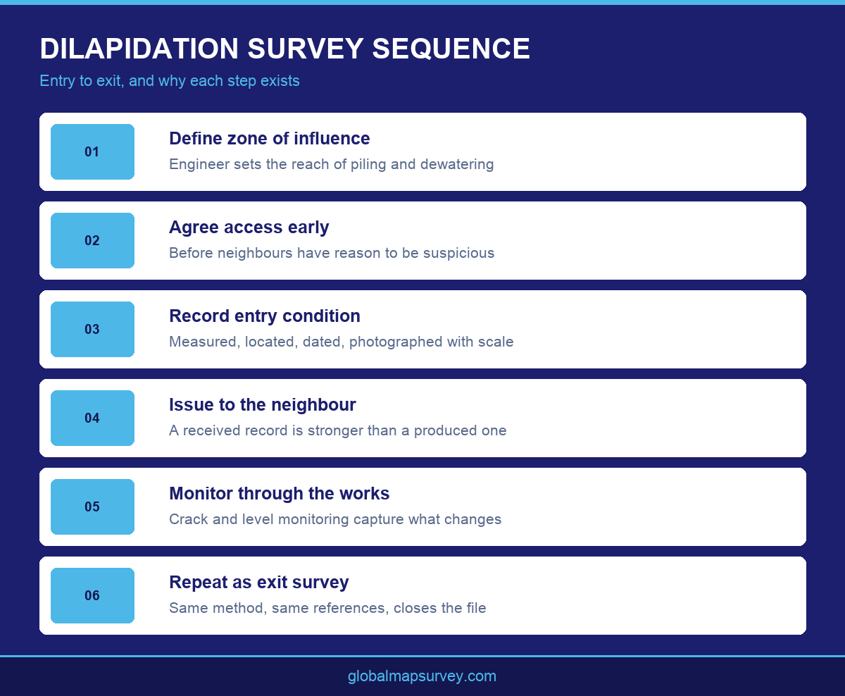
Scope should follow the zone of influence of the proposed works, not the property boundary. Piling, deep excavation, dewatering and heavy plant movement all have a reach, and any structure inside that reach is a potential claimant. The geotechnical engineer is usually the person who can define it.
Scope also has to state how far inside each property the survey goes. External elevations alone will not defend a claim about internal finishes, and gaining access after a dispute has started is far harder than gaining it beforehand. Boundary walls, hardstanding, drainage covers and services are all routinely omitted and routinely claimed against.
Getting access agreed is often the longest part of the process. Owners have no obligation to cooperate and may be suspicious of the request. Approaching neighbours early, explaining that the record protects them as much as the developer, tends to work better than a request sent once machinery is already on site.
Party wall arrangements and similar neighbourly agreements often set the scope in practice. Where a formal party wall relationship exists, the agreement itself may specify what must be recorded and when, and the survey should be written to satisfy that rather than designed independently and reconciled afterwards.
Recording Condition So It Cannot Be Disputed
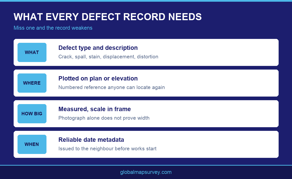
Every defect needs three things: what it is, where it is and how big it is. A photograph showing a crack proves the crack existed but not its width, and width is usually the disputed point. A scale in frame turns an image into a measurement.
Location must be unambiguous. A photograph captioned as an external wall crack is close to useless on a building with many external walls. Defects should be numbered and plotted on an elevation or floor plan so any reader can stand in the right place and look at the right thing. Where the geometry is complex, 3D laser scanning captures the whole surface and removes the question of what was and was not looked at.
Dating is what makes the file evidence. Photographs should carry reliable date metadata, the report should state the survey dates explicitly, and the completed record should be issued to the neighbouring owner before works begin. A record the other side has already received is far stronger than one produced for the first time during a dispute.
Consistency of method across every property matters as much as thoroughness on any one. If one building is recorded with measured crack widths on a numbered plan and the next is covered by a handful of captioned photographs, the weaker record becomes the one the claim is made against. A single documented method applied everywhere removes that vulnerability. Where accurate geometry is also needed, a measured building survey can be captured in the same visit.
Pairing the Survey With Monitoring
A dilapidation survey establishes the starting condition. It says nothing about what happens next. If a crack appears during construction, the survey proves it was not there before, but not when it appeared or what it coincided with.
That is why the survey is normally paired with monitoring on projects where the risk is real. Crack monitoring on any significant existing cracks, and level monitoring on the neighbouring structure, produce a continuous record through the works. Together they answer both halves of the question.
Monitoring also changes the commercial dynamic. A claim made at the end of a project against a developer holding only a dilapidation survey becomes a technical argument. The same claim against a developer holding a dilapidation survey plus a movement record spanning the works, including a record of settlement movement during construction, usually resolves much faster.
The monitoring frequency should reflect the neighbour’s exposure, not just the developer’s programme. A structure directly alongside a deep excavation warrants closer attention than one at the edge of the zone of influence, and setting frequency accordingly demonstrates that the risk was actively managed rather than uniformly assumed.
It is also worth agreeing what constitutes a reportable change before monitoring starts. Neighbours who receive monitoring updates will reasonably ask what the numbers mean, and a programme with agreed thresholds can answer that consistently. Without them, every reading invites a fresh negotiation about whether the movement matters, which erodes goodwill precisely when it is most useful.
Closing the Record Out
The exit survey is the step most often skipped and the one that converts the exercise into a closed file. Repeating the survey after works finish, using the same method and the same defect references, produces a direct comparison against the entry record.
Where nothing has changed, the exit survey removes the possibility of a claim being raised months later about damage that predates or postdates the works. Where something has changed, it is far better to know before demobilisation, while the contractor and the evidence are still available.
Retention matters too. Claims can arrive long after practical completion, so the full record including original photographs, plans, defect schedules and issue correspondence needs to survive in a form that can be produced intact. Safety obligations around adjacent occupied property, of the kind set out by the Health and Safety Executive, make that documentation trail useful well beyond the commercial dispute.
Handling a claim well also depends on knowing who holds what. The developer, contractor and insurer may each need access to the record at short notice, sometimes years later. Agreeing at the outset where the file lives, who maintains it and how it is released avoids the situation where a strong evidence pack exists but nobody can produce it within the time a claim allows.
Conclusion
Dilapidation survey services in UAE work when the scope follows the zone of influence, every defect is measured and located, the record is dated and issued before works begin, and monitoring runs alongside to capture change. Treated as a legal evidence exercise rather than a site walk, the survey usually prevents the dispute rather than merely surviving it. Global Maps Survey Services delivers dilapidation surveys across Abu Dhabi and the UAE. Contact us to scope one for your site.
AN ISO 9001-2015 CERTIFIED COMPANY