Home \ Blog \ How AI Is Transforming Utility Survey Services in UAE
How AI Is Transforming Utility Survey Services in UAE
June 15, 2026
Introduction
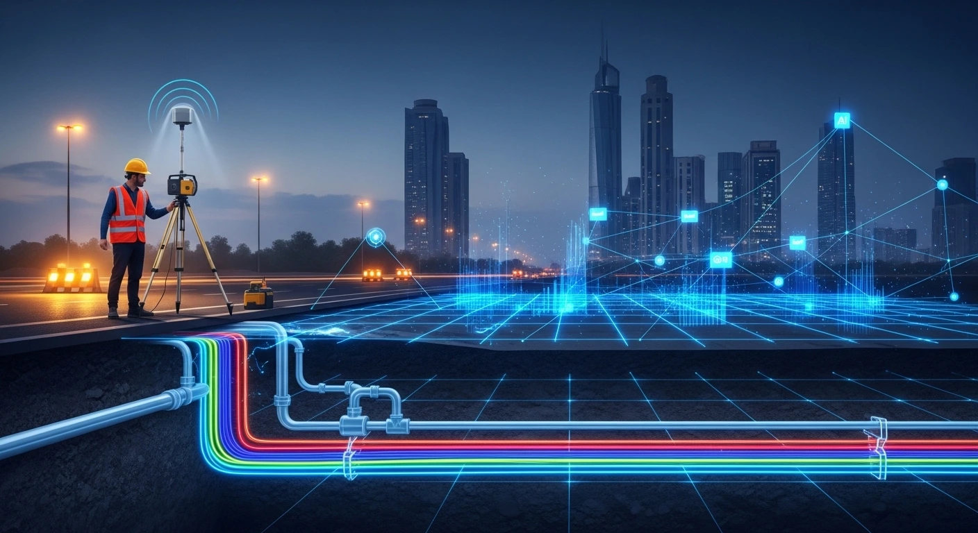
The UAE’s construction sector is growing faster than ever, and so are the risks buried beneath the surface. Every infrastructure project depends on knowing exactly where underground utilities lie before any excavation begins. Utility survey services in UAE are now at a turning point, as artificial intelligence enters the field and redefines what accurate, efficient subsurface mapping looks like. This blog walks you through how AI is improving detection methods, data accuracy, and project safety across the UAE, including key developments in utility survey services in Abu Dhabi.
Key Takeaways
- AI is enhancing the speed and accuracy of utility survey services in UAE by automating data interpretation and reducing human error.
- Technologies like Ground Penetrating Radar, radio detection, and GIS mapping are now significantly more powerful when combined with machine learning.
- Utility survey services in Abu Dhabi are meeting stricter regulatory standards thanks to AI-generated, auditable data outputs that support faster project approvals.
Why Accurate Utility Detection Is Non-Negotiable in the UAE
Underground utility data forms the foundation of every safe and compliant construction project across the region.
The UAE sits on a dense web of underground infrastructure built over decades of rapid development. Water mains, power cables, gas lines, fiber optic networks, and drainage systems crisscross beneath every city block. A single misidentified utility during excavation can lead to service outages, serious injuries, regulatory penalties, and costly project delays. According to a 2023 report by the International Association of Directional Drilling, utility strikes cost the global construction industry an estimated $50 billion annually. In fast-moving markets like the UAE, the financial and reputational stakes are even higher.
Accurate construction surveys and pre-dig utility detection are not optional steps. They are regulatory requirements and professional responsibilities that every contractor and developer must meet before breaking ground.
How AI Is Improving GPR and Radio Detection Accuracy
AI-powered signal processing makes underground detection tools faster, sharper, and far more reliable than traditional methods.
GPR surveys use radar pulses to detect buried objects beneath the surface. Traditionally, interpreting GPR data required experienced analysts to manually review complex waveform outputs, a process that was time-consuming and subject to human error. AI changes this entirely. Machine learning models trained on thousands of underground scan datasets can now automatically classify utility types, estimate burial depths, and flag potential conflicts in a fraction of the time.
Radio detection surveys work alongside GPR to trace metallic utilities such as cables, conduits, and metallic pipelines. AI-assisted signal processing filters out background interference and sharpens signal resolution, which results in more precise depth and location readings. Together, GPR and radio detection paired with AI provide a comprehensive, high-confidence picture of what lies underground before any machinery is deployed.
The Role of AI-Integrated GIS in Utility Mapping
Combining AI with geographic information systems gives project teams a smarter, more complete view of underground utility networks.
GIS mapping has long been a core tool in utility survey work. AI integration transforms GIS platforms from static storage systems into dynamic spatial intelligence tools. AI-powered GIS can merge drone imagery, satellite data, historical survey records, and live field measurements into a single unified map layer that updates in real time.
This matters enormously for utility survey services in UAE, where projects often span complex urban environments with years of legacy underground infrastructure. AI enables spatial conflict detection, automatically identifying where new development plans intersect with existing buried assets. Project teams receive clear, actionable insights rather than raw data files that require hours of manual interpretation. The result is fewer surprises during excavation, faster regulatory approvals, and better coordination between contractors, engineers, and site managers.
Structured data outputs from AI-enhanced surveys also move through data processing pipelines faster, ensuring that project stakeholders receive verified, project-ready deliverables on tighter timelines.
Key AI Technologies Driving Utility Survey Innovation
From machine learning anomaly detection to real-time reporting dashboards, AI brings a suite of powerful capabilities to modern utility surveys.
Several AI-powered tools are now being adopted by leading utility survey providers across the UAE:
- Machine Learning for Anomaly Detection: AI models scan GPR and electromagnetic data to automatically identify irregular patterns that may indicate buried utilities, voids, or structural risks.
- Automated Object Classification: Instead of manual review, AI classifies each detected object by material type, depth, and orientation, significantly reducing interpretation time.
- AI Vision in Drone Surveys: Unmanned aerial vehicles equipped with AI-powered sensors can cover large surface areas rapidly, feeding processed data directly into GIS platforms.
- Predictive Utility Mapping: Using historical survey datasets, AI predicts zones of high buried utility density, helping teams prioritize risk areas before excavation begins.
- Real-Time Reporting Platforms: AI-driven dashboards aggregate field data and generate instant, structured reports that project managers can act on immediately.
These innovations are setting a new standard for utility survey services in UAE, moving the industry away from reactive detection and toward proactive, intelligence-driven planning.
Meeting Abu Dhabi’s High Standards with AI-Enhanced Surveys
Utility survey services in Abu Dhabi must meet stringent regulatory standards, and AI-generated data outputs are making compliance faster and more reliable.
Abu Dhabi applies detailed requirements for utility detection and verification before any excavation or major construction activity is authorized. Regulatory frameworks from bodies such as the Abu Dhabi Department of Energy and associated municipal authorities require surveyors to produce verified, high-accuracy utility maps with clear documentation of methodology and data sources.
AI-enhanced utility surveys meet these requirements effectively. Every data point captured through AI-assisted GPR and radio detection can be traced, timestamped, and formatted into structured deliverables that satisfy audit requirements. This level of documentation reduces back-and-forth with regulatory reviewers and shortens the pre-approval phase of major projects.
Site investigation surveys conducted ahead of construction benefit greatly from AI integration. Pre-project investigations that combine AI-assisted utility mapping with geotechnical data help developers and contractors identify underground risks early, well before costly equipment is mobilized. For large-scale projects across Abu Dhabi, from road expansions to waterfront infrastructure, AI-enhanced pre-construction surveying is rapidly becoming a standard requirement rather than an added option.
The growing adoption of AI in utility survey services in Abu Dhabi reflects a broader regional commitment to safer, smarter, and more efficient infrastructure delivery.
Conclusion
AI is no longer a future concept in the surveying industry. It is already delivering measurable improvements across utility survey services in UAE, from faster GPR interpretation to smarter GIS-based utility mapping. Construction teams, engineers, and developers working across the UAE and Abu Dhabi now have access to more accurate underground data than ever before, delivered faster and documented to the highest standards. As infrastructure projects grow in scale and complexity, AI-enhanced utility surveys will be an essential tool for managing risk and driving efficiency. Contact Global Map Survey to learn how our services can support your next project.
Frequently Asked Questions
What are utility survey services in UAE?
Utility survey services in UAE involve locating, mapping, and documenting underground utilities such as pipes, cables, and conduits before excavation begins. These surveys protect infrastructure, ensure safety, and support regulatory compliance across construction and engineering projects.
How does AI improve utility surveys?
AI improves utility surveys by automating the interpretation of GPR and electromagnetic sensor data. Machine learning models classify buried objects, estimate depths, and identify conflicts faster and more accurately than traditional manual analysis, reducing both project risk and turnaround time.
What is GPR and how is it used in utility mapping?
Ground Penetrating Radar is a non-invasive detection technology that uses radar pulses to locate buried objects beneath the surface. It is widely used in utility mapping to identify the position and depth of underground pipes, cables, and conduits without excavation.
Why are utility surveys required before construction in the UAE?
Utility surveys are required before construction in the UAE to prevent accidental damage to underground infrastructure. Damaging buried utilities during excavation can cause service disruptions, safety incidents, regulatory penalties, and significant project delays. Thorough pre-construction services that include utility detection help teams identify risks well before any machinery is deployed.
What technologies are used in AI-powered utility surveys?
AI-powered utility surveys use GPR, radio detection, drone-mounted sensors, and GIS platforms enhanced by machine learning. These tools work together to detect, classify, and map buried utilities with greater speed and accuracy than conventional survey approaches.
How do utility survey services in Abu Dhabi meet regulatory standards?
Utility survey services in Abu Dhabi follow requirements set by municipal and energy authorities. AI-assisted surveys produce structured, auditable data outputs that demonstrate methodology, accuracy, and traceability, helping project teams meet approval requirements more efficiently.
What is the difference between GPR surveys and radio detection surveys?
GPR surveys use radar energy to detect all buried objects including non-metallic ones, while radio detection surveys use electromagnetic signals to trace metallic utilities such as cables and pipes. Both methods are often used together for comprehensive utility mapping across complex underground environments.
How does GIS mapping support utility survey services?
GIS mapping organizes utility survey data into spatial layers that engineers can reference during project planning. When combined with AI, GIS platforms can merge multiple data sources and detect spatial conflicts between proposed construction and existing underground assets in real time.
What sectors benefit most from AI-enhanced utility surveys in the UAE?
Infrastructure developers, civil engineering firms, real estate developers, and government project teams benefit most from AI-enhanced utility surveys. Any sector that requires excavation or underground construction across the UAE relies on accurate subsurface data to manage risk and ensure compliance.
How can I choose the right utility survey provider in UAE?
Choose a provider that uses advanced detection technologies, follows recognized survey standards, and delivers structured data outputs suitable for regulatory submission. Understanding the surveying techniques a provider uses, along with their experience in local UAE project environments, helps you evaluate their capability and reliability.
AN ISO 9001-2015 CERTIFIED COMPANY