Home \ Blog \ Complete Guide to Property Survey Services in UAE
Complete Guide to Property Survey Services in UAE
June 10, 2026
The UAE is one of the most ambitious construction and real estate markets in the world. Accurate property survey services in UAE sit at the heart of every successful development, from residential towers in Dubai to large infrastructure corridors across Abu Dhabi and Sharjah. Without verified survey data, projects face boundary disputes, structural errors, and regulatory setbacks. This guide walks you through the key types of property surveys, why they matter at every project phase, and how to select the right surveying partner for your next development in the UAE.
Key Takeaways
- Property survey services in UAE provide the spatial accuracy needed for safe, compliant, and cost-effective construction.
- Core survey types include boundary, topographic, land, construction, and as-built surveys, each serving a distinct phase of the project lifecycle.
- Advanced technologies such as drone mapping, LiDAR scanning, and GIS platforms are redefining how surveys are delivered across the region.
Why Property Survey Services Are Critical in the UAE
Accurate survey data protects developers, engineers, and investors from costly errors that become far more expensive to resolve once construction begins.
The UAE’s pace of urban growth leaves no margin for data errors. Property survey services in UAE help developers confirm land boundaries, assess site terrain, and uncover potential issues before a single foundation is poured. Projects that skip this step are exposed to boundary disputes, design conflicts, and regulatory delays that can stall timelines and inflate budgets significantly.
The Royal Institution of Chartered Surveyors notes that errors identified during the pre-construction phase cost up to ten times less to resolve than those discovered after work has started. In a market where investor expectations and project timelines are both extremely demanding, professional survey data reduces risk and builds confidence among all stakeholders from day one. Every major development in the UAE, from high-rise towers in Dubai Marina to mega-infrastructure schemes in Yas Island, depends on a solid survey foundation.
Types of Property Survey Services Available in the UAE
Understanding the full range of survey types helps developers and project managers assign the right method to each stage of their project.
The UAE property and construction sectors rely on a range of specialised survey categories. Boundary and topographic surveys define legal property limits and record the physical landscape, providing a verified baseline for architects and planners. Construction surveys deliver on-site positional guidance throughout the build phase, ensuring structures are placed exactly where engineering drawings specify.
Once a project reaches completion, as-built surveys document the final constructed condition, a requirement for government approvals and long-term asset management across the UAE. Professionals also conduct site investigation surveys, setting-out surveys, and deformation monitoring throughout a project’s lifecycle. Each survey type contributes a verified layer of spatial data that supports better decisions at every stage.
Common Survey Types Used in UAE Property Projects:
- Topographic surveys: capture site terrain, elevation, and surface features
- Boundary surveys: define legal property extents and ownership limits
- Construction surveys: provide positional control during the build phase
- As-built surveys: document the final state of a completed structure
- Setting-out surveys: mark precise positions for structural elements on site
Land Surveys: The Foundation of Every UAE Development
Professional land surveys deliver the spatial baseline that engineers, architects, and developers rely on to plan and execute projects with confidence.
Land surveys are the starting point for virtually every construction and real estate project across the UAE. They collect precise measurements of a site’s physical features, elevation, and boundaries, creating a verified data layer for all downstream project activities. Having reliable land data at the outset shortens planning cycles, reduces design changes, and prevents expensive on-site disputes.
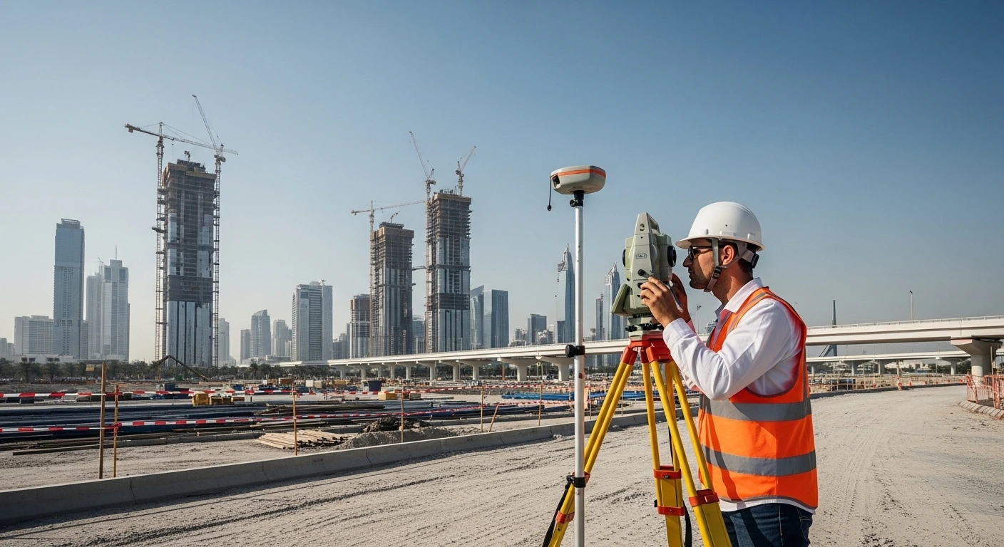
Surveyors use advanced instruments including total stations, GNSS receivers, and 3D scanning equipment to collect data that feeds directly into architectural and engineering models. These datasets integrate seamlessly with GIS platforms, allowing project teams to visualise and analyse spatial information in real time. Whether a project covers a compact urban plot in downtown Dubai or a large greenfield development on the outskirts of Abu Dhabi, land surveys ensure every decision is grounded in verified, accurate data.
Property Survey Services in Dubai: Unique Demands and Precise Solutions
Dubai’s regulatory environment and fast-evolving urban landscape require property survey services tailored to its specific planning and development conditions.
Property survey services in Dubai operate within one of the most regulated and high-demand real estate markets in the world. The Dubai Land Department requires accurate, certified property documentation for all new developments, title deed registrations, and plot transfers. Non-compliant survey data can delay approvals and create costly legal complications for developers and landowners alike.
The city presents diverse surveying challenges, including reclaimed coastal land, high-density commercial districts, and large-scale infrastructure projects under simultaneous development. Survey firms providing property survey services in Dubai use aerial mapping, 3D laser scanning, and GIS-integrated workflows to deliver reliable results within tight project timelines. The Dubai Land Department publishes detailed guidelines on property measurement and registration standards that all surveys must align with.
With the Dubai 2040 Urban Master Plan driving sustained densification and new development zones, demand for precise property surveys across the emirate will only increase in the years ahead.
How Technology Is Transforming Property Surveys Across the UAE
Modern survey technologies deliver faster, more accurate, and more detailed data than traditional methods, directly improving project outcomes across the region.
Technology has fundamentally changed how property surveys are conducted in the UAE. Drone-based aerial mapping, LiDAR scanning, and real-time GIS platforms allow survey teams to collect data at speed and with far greater precision across large or complex sites. These tools are particularly valuable in the UAE, where major projects often span extensive areas with varied terrain or restricted access conditions.
3D laser scanning captures highly detailed point cloud data of existing structures and environments, supporting setting out services and complex renovation projects with exceptional accuracy. GIS mapping platforms allow survey data to be layered alongside other project datasets, improving coordination between engineers, planners, and contractors throughout the build. According to the global geospatial industry body FIG (International Federation of Surveyors), the adoption of digital survey technologies is reducing fieldwork time by up to 40% on large-scale infrastructure projects. These advances mean UAE survey firms now deliver faster turnarounds, richer datasets, and higher accuracy than was possible a decade ago.
Choosing the Right Property Survey Partner in the UAE
Selecting a qualified and experienced surveying firm ensures your project data is accurate, compliant, and delivered on time, every time.
When evaluating property survey services in UAE, several factors set a reliable partner apart from a basic data provider. Assess the firm’s experience with projects of similar scale, its use of current survey equipment, and its track record across the UAE and the wider Gulf region. Look for firms that hold recognised quality management certifications and demonstrate a clear understanding of UAE planning and regulatory requirements.
A capable survey partner does more than collect data. They advise on the most appropriate survey methods for site conditions, integrate outputs with your engineering and design workflows, and provide clear documentation for regulatory submissions. Whether your project requires topographic mapping, construction survey control, deformation monitoring, or full as-built documentation, working with a full-service firm reduces coordination complexity and strengthens project confidence at every milestone.
Conclusion
Precise property survey services in UAE are the foundation of every successful construction, real estate, and infrastructure project across the region. From initial topographic assessments to final as-built records, professional surveys ensure every project decision is based on verified, accurate ground data. Whether your development is located in Dubai, Abu Dhabi, or elsewhere across the UAE, partnering with an experienced surveying team protects your investment and supports full regulatory compliance. Contact Global Map Survey today to learn how our comprehensive survey services can support your next project from the planning stage through to completion.
Frequently Asked Questions
What are property survey services in UAE?
Property survey services in UAE involve professional measurement, mapping, and documentation of land and structures. They cover boundary surveys, topographic mapping, construction setout, and as-built documentation, helping developers, engineers, and investors make decisions based on accurate spatial data.
Why is a property survey important before buying land in the UAE?
A property survey confirms legal boundaries, identifies encroachments, and verifies land dimensions before any purchase. In the UAE, this protects buyers from costly disputes and ensures the plot matches official title deed records held by the relevant land authority.
How long does a property survey take in Dubai?
The duration depends on site size and survey type. A standard boundary survey in Dubai typically takes one to three days, while larger topographic or construction surveys for major developments may require several weeks to complete fully.
What is the difference between a boundary survey and a topographic survey?
A boundary survey defines the legal extents of a property and confirms ownership limits. A topographic survey records the physical features and elevation of a site. Both are essential inputs for accurate land and construction planning across the UAE.
What technology is used in property survey services in UAE?
Modern property survey services in UAE use GNSS receivers, total stations, 3D laser scanners, and drone-based aerial mapping. These technologies improve data accuracy, reduce fieldwork time, and support GIS mapping platforms used in large-scale project planning.
Do I need a property survey before starting a construction project in Dubai?
Yes. A property survey is essential before starting any construction project in Dubai. Pre-construction services including topographic and boundary surveys provide the verified site data architects and engineers need for safe and compliant project design.
What is an as-built survey and when is it required in the UAE?
An as-built survey documents the exact dimensions and positions of a completed structure. In the UAE, it is required for government approvals, facility management, and handover documentation, confirming that the finished build matches the approved engineering design specifications.
How do property surveys help resolve boundary disputes in the UAE?
Property surveys provide legally referenced measurements and spatial data that clarify exact boundary positions. In the UAE, certified survey reports are accepted in legal proceedings and property registration processes, helping resolve disputes quickly, accurately, and with full regulatory backing.
What is a site investigation survey and how does it support property development?
A site investigation survey assesses ground conditions, utility locations, and potential hazards before construction begins. It provides developers with critical subsurface data that reduces project risk, informs foundation design, and supports full regulatory compliance across UAE property projects.
How do I choose a reliable property survey company in the UAE?
Look for a firm with proven experience across UAE construction and infrastructure projects, certified quality management systems, and a full range of modern survey technologies. A reliable partner provides clear deliverables aligned with UAE planning and regulatory standards.
AN ISO 9001-2015 CERTIFIED COMPANY