Home \ Blog \ What Makes Reliable Hydrographic Survey Companies in UAE
What Makes Reliable Hydrographic Survey Companies in UAE
June 9, 2026
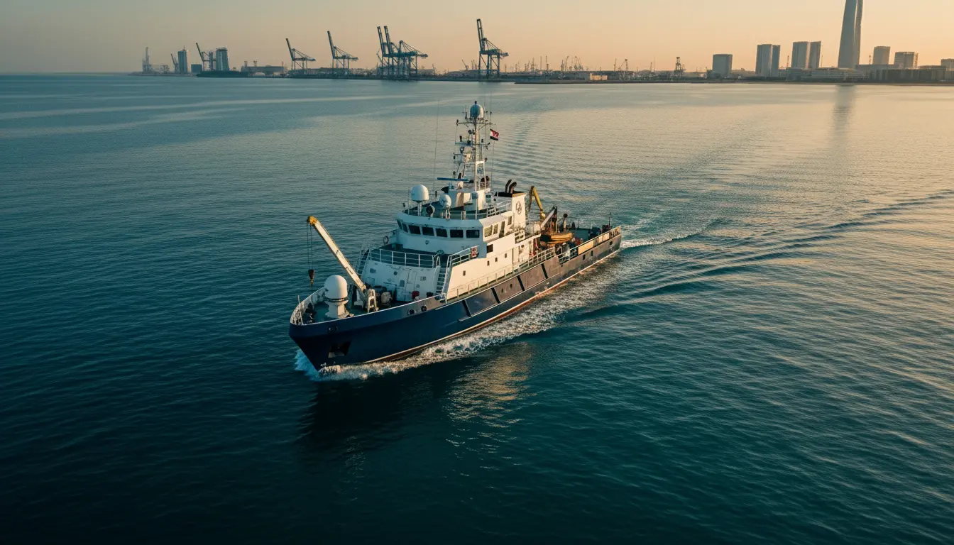
The UAE’s coastline stretches across more than 1,318 kilometers, supporting one of the most active maritime economies in the world. From large-scale port expansions to offshore pipeline installations, accurate underwater data is non-negotiable. Experienced marine surveyors in the UAE play a central role in the nation’s infrastructure ecosystem. This blog covers what hydrographic surveys involve, the key services offered by leading firms, and what distinguishes the best hydrographic survey companies in UAE. Whether you are a developer, engineer, or project manager, this guide helps you make an informed decision.
Key Takeaways
- Hydrographic survey companies in UAE provide critical underwater data for port development, dredging operations, and coastal infrastructure projects.
- Dubai and Abu Dhabi are the primary hubs for marine survey activity in the UAE region.
- Leading companies use advanced sonar systems, ADCP instruments, and bathymetric technologies to deliver precise underwater data.
- Choosing the right partner requires evaluating equipment standards, technical experience, local regulatory knowledge, and the full range of services offered.
What Is a Hydrographic Survey and Why Does It Matter?
Hydrographic surveys map underwater terrain to support safe navigation, marine construction, and coastal planning decisions.
A hydrographic survey is a scientific process that measures and describes the physical features of water bodies, including ocean floors, riverbeds, harbors, and coastal zones. It collects data such as water depths, tidal patterns, seabed composition, and submerged obstacles. This data is essential for engineers, port authorities, and construction teams who need to fully understand the marine environment before starting any offshore or nearshore project.
In the UAE, hydrographic data underpins nearly every major maritime project. The country’s ports, including Jebel Ali and Khalifa Port, are among the busiest in the world. Managing vessel navigation, planning dredging operations, and executing offshore construction all depend on reliable, up-to-date hydrographic information. Without it, project risks increase significantly, and costly delays become far more likely.
Hydrographic surveys also support environmental monitoring. Tracking changes in seabed sediment, water quality, and tidal behavior helps coastal managers and government bodies make evidence-based decisions. As UAE infrastructure continues to grow, so does the demand for precise and regularly updated hydrographic data from experienced survey firms.
Core Services Offered by Hydrographic Survey Companies in UAE
Leading UAE companies offer bathymetric surveys, SONAR imaging, dredging support, and offshore positioning as core marine services.
Hydrographic survey companies in UAE deliver a comprehensive range of underwater survey services. Detailed depth mapping through multibeam and singlebeam bathymetric surveys forms the foundation of navigational charts and is critical for port planning and vessel route optimization. These methods provide high-resolution measurements across harbors, channels, and open water areas.
Seabed imagery captured through side scan SONAR surveys and mosaicing identifies submerged pipelines, debris, sand formations, and other underwater features that may affect construction or navigation safety. This technique is particularly valuable for offshore energy projects and submarine cable route assessments.
Project teams managing excavation work rely on pre and post dredging bathymetric services to verify that dredging meets required depth specifications and to accurately calculate material volumes. Additional services include tidal observation, seabed sampling, current meter observations, and meteorological monitoring. Companies that offer this full range of marine survey capabilities provide greater value to large infrastructure clients who require multiple data layers for planning and execution.
Why Dubai Is a Growing Hub for Hydrographic Survey Activity
Dubai’s expanding ports and offshore developments make hydrographic survey companies in Dubai an essential part of regional project delivery.
Dubai is one of the fastest-growing maritime hubs in the Middle East. Its coastline hosts some of the region’s most ambitious infrastructure projects, from artificial island developments to deep-water port expansions. This makes hydrographic survey companies in Dubai an indispensable part of project delivery across the emirate. Accurate, real-time underwater data supports every phase of development, from feasibility studies and design to construction monitoring and post-completion verification.
The expansion of Jebel Ali Port, the development of Dubai Maritime City, and ongoing offshore construction activities all require continuous hydrographic monitoring. Survey companies operating in Dubai must navigate complex tidal conditions, fluctuating sediment levels, and high-traffic marine zones. This demands not only advanced equipment but also significant local knowledge and operational experience built over many years.
According to the International Hydrographic Organization, accurate hydrographic data is a fundamental requirement for maritime safety, coastal resource management, and infrastructure planning. Companies that align with IHO standards deliver more reliable outputs and reduce the risk of costly project errors caused by inaccurate or outdated underwater data.
Key Technologies Used by Hydrographic Survey Companies in UAE
Leading companies deploy multibeam sonar, sub-bottom profilers, and ADCP systems to collect comprehensive underwater project data.
The quality of any hydrographic survey is directly tied to the technology used in the field. Top hydrographic survey companies in UAE invest in state-of-the-art equipment to deliver precise, repeatable results. Multibeam echo sounders provide full seabed coverage by emitting a fan of sonar beams, generating detailed 3D depth models in a single vessel pass. This technology is far more efficient than traditional single-beam methods, particularly in deep or geometrically complex water environments.
ADCP (Acoustic Doppler Current Profiler) systems measure water current velocities at multiple depth intervals. This data is essential for tidal studies, flood risk modeling, and assessing the impact of new coastal structures on existing water flow patterns. Geological conditions beneath the seabed, including buried cables, sediment layering, and pile-bearing strata, are identified through sub-bottom profiling and magnetometer surveys, which are especially critical for pipeline design and offshore foundation engineering.
Companies that maintain a modern fleet of sonar, positioning, and monitoring instruments are better equipped to handle the UAE’s diverse marine environments, from shallow coastal areas to open-water offshore zones. Modern technology also reduces field time and turnaround, directly benefiting project schedules and overall costs.
How to Choose the Right Hydrographic Survey Company in UAE
Evaluate experience, equipment quality, local regulatory knowledge, and service range when selecting a hydrographic survey partner in UAE.
Choosing from the many hydrographic survey companies in UAE requires a structured evaluation process. Start by reviewing the company’s track record in similar project environments. A firm with extensive offshore experience may not be the ideal fit for shallow harbor surveys, and vice versa. Request references and project portfolios that closely match your specific project type and location.
Next, assess the equipment and field technology the company deploys. Firms that operate modern multibeam sonar systems, ADCP instruments, and high-accuracy offshore positioning tools deliver more reliable results with fewer field revisits, integrating multiple survey data streams within a single project engagement.
Local regulatory knowledge is also a critical selection factor. Marine projects in the UAE often require permits and approvals from maritime and environmental authorities. Experienced companies manage this process smoothly, reducing delays. Verify that the company follows IHO standards and that its deliverables match the data format requirements of your engineering or planning team. Finally, consider the firm’s responsiveness, communication standards, and project management capacity. In fast-moving construction environments, timely survey data delivery can be the difference between on-schedule and over-budget project completion.
Conclusion
The demand for skilled hydrographic survey companies in UAE will only grow as the nation continues expanding its coastal and offshore infrastructure. Selecting the right partner means evaluating technology, project experience, and the full breadth of marine services on offer. Accurate hydrographic data is the foundation of safe, efficient, and cost-effective maritime infrastructure. Global Map Survey supports construction firms, port developers, and engineering teams across the UAE with precise hydrographic and coastal survey solutions. Contact us today to discuss your project requirements.
Frequently Asked Questions
What do hydrographic survey companies in UAE typically offer?
Hydrographic survey companies in UAE offer services including bathymetric surveys, side scan SONAR imaging, tidal observation, seabed sampling, dredging volume surveys, and offshore positioning. These services support port development, offshore construction, pipeline installation, and coastal management projects across the UAE.
How are hydrographic surveys used in port construction?
Hydrographic surveys provide depth data, seabed conditions, and tidal patterns needed for port design and dredging. They help engineers determine vessel channel depths, plan berth layouts, and monitor changes in the seabed during and after construction to ensure safe and efficient port operations.
What makes hydrographic survey companies in Dubai different from others in the region?
Hydrographic survey companies in Dubai operate in one of the most complex marine environments in the Middle East, with busy shipping lanes, artificial islands, and ongoing large-scale development. This demands high technical capability, local regulatory knowledge, and experience managing surveys in active, high-traffic marine zones.
What is a bathymetric survey and why is it important?
A bathymetric survey measures water depths across a specific area using sonar technology. It generates accurate underwater terrain maps that are essential for navigation planning, dredging projects, offshore construction, and coastal infrastructure development, forming the foundation of safe marine project execution.
How long does a hydrographic survey take?
Survey duration depends on the area size, water depth, and data complexity required. A small harbor survey may take a few days, while large offshore projects can take several weeks. Companies with modern multibeam sonar equipment typically complete surveys faster than those using older single-beam systems.
What standards do hydrographic survey companies follow in UAE?
Most professional hydrographic survey companies in the UAE follow International Hydrographic Organization (IHO) standards, particularly the S-44 specification for data quality and accuracy. Compliance with these standards ensures that survey data is reliable, consistent, and accepted by port authorities, engineering firms, and government agencies.
What is the difference between multibeam and singlebeam bathymetric surveys?
Multibeam systems collect depth data across a wide swath of the seabed in a single pass, producing high-resolution 3D maps. Single-beam systems measure depth along a narrow line and are better suited to smaller or shallower areas. Multibeam surveys are faster and more detailed for large-scale marine projects.
Are hydrographic surveys needed for dredging projects in UAE?
Yes. Pre-dredging surveys establish baseline depth data, while post-dredging surveys verify that target depths were achieved and calculate removed volumes. This process ensures quality control, regulatory compliance, and accurate billing for dredging contractors working on UAE port and coastal development projects.
Can hydrographic surveys support environmental monitoring in UAE coastal zones?
Yes. Hydrographic surveys track seabed changes, sediment movement, tidal variations, and water current patterns over time. This data supports coastal environmental assessments and impact studies for nearshore construction. Teams working on water quality assessments often combine this with salinity and temperature observation data for a more complete environmental picture.
What should I look for when hiring a hydrographic survey company in UAE?
Look for proven experience in UAE waters, modern survey equipment, IHO-compliant data products, and a wide range of marine services. Strong project management, local permit knowledge, and a portfolio of completed projects similar to yours are key indicators of a reliable partner. Teams requiring broader support can also benefit from survey contracting and consultancy expertise.
AN ISO 9001-2015 CERTIFIED COMPANY