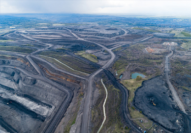


Topographic survey and Mapping
Topographic survey and Mapping Contour mapping Establishing survey control networks Geographic Survey Demarcation/Boundary pegging services Precise levelling Construction surveys Pre-construction services Project management-Site control Establishment of gridlines and datum Profile levelling & Cross-section Surveys Gate-level Computation Services Measured building surveys As-built surveys Survey Contracting and Consultancy Setting out services Digitisation Data processing GIS Mapping Project […]
Discover MoreContour mapping
Topographic survey and Mapping Contour mapping Establishing survey control networks Geographic Survey Demarcation/Boundary pegging services Precise levelling Construction surveys Pre-construction services Project management-Site control Establishment of gridlines and datum Profile levelling & Cross-section Surveys Gate-level Computation Services Measured building surveys As-built surveys Survey Contracting and Consultancy Setting out services Digitisation Data processing GIS Mapping Project […]
Discover More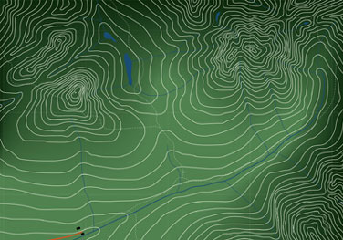
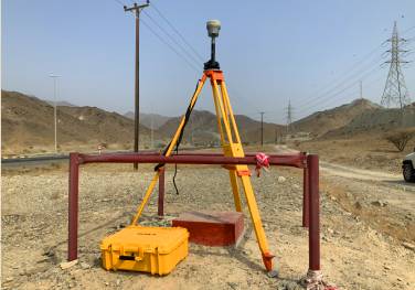
Establishing survey control networks
Topographic survey and Mapping Contour mapping Establishing survey control networks Geographic Survey Demarcation/Boundary pegging services Precise levelling Construction surveys Pre-construction services Project management-Site control Establishment of gridlines and datum Profile levelling & Cross-section Surveys Gate-level Computation Services Measured building surveys As-built surveys Survey Contracting and Consultancy Setting out services Digitisation Data processing GIS Mapping Project […]
Discover MoreGeographic Survey
Topographic survey and Mapping Contour mapping Establishing survey control networks Geographic Survey Demarcation/Boundary pegging services Precise levelling Construction surveys Pre-construction services Project management-Site control Establishment of gridlines and datum Profile levelling & Cross-section Surveys Gate-level Computation Services Measured building surveys As-built surveys Survey Contracting and Consultancy Setting out services Digitisation Data processing GIS Mapping Project […]
Discover More
Demarcation/Boundary pegging services
Topographic survey and Mapping Contour mapping Establishing survey control networks Geographic Survey Demarcation/Boundary pegging services Precise levelling Construction surveys Pre-construction services Project management-Site control Establishment of gridlines and datum Profile levelling & Cross-section Surveys Gate-level Computation Services Measured building surveys As-built surveys Survey Contracting and Consultancy Setting out services Digitisation Data processing GIS Mapping Project […]
Discover MorePrecise levelling
Topographic survey and Mapping Contour mapping Establishing survey control networks Geographic Survey Demarcation/Boundary pegging services Precise levelling Construction surveys Pre-construction services Project management-Site control Establishment of gridlines and datum Profile levelling & Cross-section Surveys Gate-level Computation Services Measured building surveys As-built surveys Survey Contracting and Consultancy Setting out services Digitisation Data processing GIS Mapping Project […]
Discover More

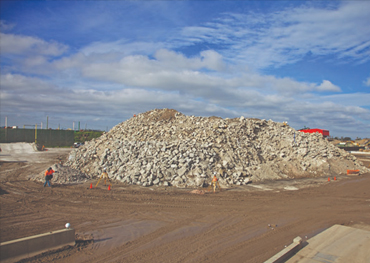
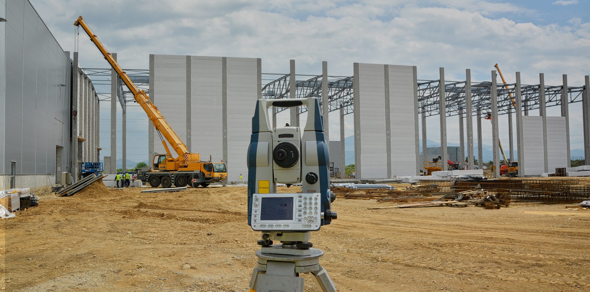
Construction surveys
Topographic survey and Mapping Contour mapping Establishing survey control networks Geographic Survey Demarcation/Boundary pegging services Precise levelling Construction surveys Pre-construction services Project management-Site control Establishment of gridlines and datum Profile levelling & Cross-section Surveys Gate-level Computation Services Measured building surveys As-built surveys Survey Contracting and Consultancy Setting out services Digitisation Data processing GIS Mapping Project […]
Discover MorePre-construction services
Topographic survey and Mapping Contour mapping Establishing survey control networks Geographic Survey Demarcation/Boundary pegging services Precise levelling Construction surveys Pre-construction services Project management-Site control Establishment of gridlines and datum Profile levelling & Cross-section Surveys Gate-level Computation Services Measured building surveys As-built surveys Survey Contracting and Consultancy Setting out services Digitisation Data processing GIS Mapping Project […]
Discover More

Project management-Site control
Topographic survey and Mapping Contour mapping Establishing survey control networks Geographic Survey Demarcation/Boundary pegging services Precise levelling Construction surveys Pre-construction services Project management-Site control Establishment of gridlines and datum Profile levelling & Cross-section Surveys Gate-level Computation Services Measured building surveys As-built surveys Survey Contracting and Consultancy Setting out services Digitisation Data processing GIS Mapping Project […]
Discover MoreEstablishment of gridlines and datum
Topographic survey and Mapping Contour mapping Establishing survey control networks Geographic Survey Demarcation/Boundary pegging services Precise levelling Construction surveys Pre-construction services Project management-Site control Establishment of gridlines and datum Profile levelling & Cross-section Surveys Gate-level Computation Services Measured building surveys As-built surveys Survey Contracting and Consultancy Setting out services Digitisation Data processing GIS Mapping Project […]
Discover More

Profile levelling & Cross-section Surveys
Topographic survey and Mapping Contour mapping Establishing survey control networks Geographic Survey Demarcation/Boundary pegging services Precise levelling Construction surveys Pre-construction services Project management-Site control Establishment of gridlines and datum Profile levelling & Cross-section Surveys Gate-level Computation Services Measured building surveys As-built surveys Survey Contracting and Consultancy Setting out services Digitisation Data processing GIS Mapping Project […]
Discover MoreGate-level Computation Services
Topographic survey and Mapping Contour mapping Establishing survey control networks Geographic Survey Demarcation/Boundary pegging services Precise levelling Construction surveys Pre-construction services Project management-Site control Establishment of gridlines and datum Profile levelling & Cross-section Surveys Gate-level Computation Services Measured building surveys As-built surveys Survey Contracting and Consultancy Setting out services Digitisation Data processing GIS Mapping Project […]
Discover More

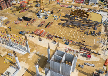
Measured building surveys
Topographic survey and Mapping Contour mapping Establishing survey control networks Geographic Survey Demarcation/Boundary pegging services Precise levelling Construction surveys Pre-construction services Project management-Site control Establishment of gridlines and datum Profile levelling & Cross-section Surveys Gate-level Computation Services Measured building surveys As-built surveys Survey Contracting and Consultancy Setting out services Digitisation Data processing GIS Mapping Project […]
Discover MoreAs-built surveys
Topographic survey and Mapping Contour mapping Establishing survey control networks Geographic Survey Demarcation/Boundary pegging services Precise levelling Construction surveys Pre-construction services Project management-Site control Establishment of gridlines and datum Profile levelling & Cross-section Surveys Gate-level Computation Services Measured building surveys As-built surveys Survey Contracting and Consultancy Setting out services Digitisation Data processing GIS Mapping Project […]
Discover More

Survey Contracting and Consultancy
Topographic survey and Mapping Contour mapping Establishing survey control networks Geographic Survey Demarcation/Boundary pegging services Precise levelling Construction surveys Pre-construction services Project management-Site control Establishment of gridlines and datum Profile levelling & Cross-section Surveys Gate-level Computation Services Measured building surveys As-built surveys Survey Contracting and Consultancy Setting out services Digitisation Data processing GIS Mapping Project […]
Discover MoreSetting out services
Topographic survey and Mapping Contour mapping Establishing survey control networks Geographic Survey Demarcation/Boundary pegging services Precise levelling Construction surveys Pre-construction services Project management-Site control Establishment of gridlines and datum Profile levelling & Cross-section Surveys Gate-level Computation Services Measured building surveys As-built surveys Survey Contracting and Consultancy Setting out services Digitisation Data processing GIS Mapping Project […]
Discover More

Digitisation
Topographic survey and Mapping Contour mapping Establishing survey control networks Geographic Survey Demarcation/Boundary pegging services Precise levelling Construction surveys Pre-construction services Project management-Site control Establishment of gridlines and datum Profile levelling & Cross-section Surveys Gate-level Computation Services Measured building surveys As-built surveys Survey Contracting and Consultancy Setting out services Digitisation Data processing GIS Mapping Project […]
Discover MoreData processing
Topographic survey and Mapping Contour mapping Establishing survey control networks Geographic Survey Demarcation/Boundary pegging services Precise levelling Construction surveys Pre-construction services Project management-Site control Establishment of gridlines and datum Profile levelling & Cross-section Surveys Gate-level Computation Services Measured building surveys As-built surveys Survey Contracting and Consultancy Setting out services Digitisation Data processing GIS Mapping Project […]
Discover More

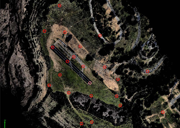
GIS Mapping
Topographic survey and Mapping Contour mapping Establishing survey control networks Geographic Survey Demarcation/Boundary pegging services Precise levelling Construction surveys Pre-construction services Project management-Site control Establishment of gridlines and datum Profile levelling & Cross-section Surveys Gate-level Computation Services Measured building surveys As-built surveys Survey Contracting and Consultancy Setting out services Digitisation Data processing GIS Mapping Project […]
Discover MoreProject Consultancy & Technical Staff Supply
Topographic survey and Mapping Contour mapping Establishing survey control networks Geographic Survey Demarcation/Boundary pegging services Precise levelling Construction surveys Pre-construction services Project management-Site control Establishment of gridlines and datum Profile levelling & Cross-section Surveys Gate-level Computation Services Measured building surveys As-built surveys Survey Contracting and Consultancy Setting out services Digitisation Data processing GIS Mapping Project […]
Discover More

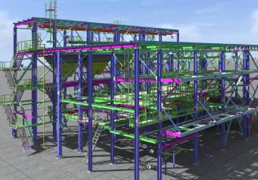
Engineering Setout
Topographic survey and Mapping Contour mapping Establishing survey control networks Geographic Survey Demarcation/Boundary pegging services Precise levelling Construction surveys Pre-construction services Project management-Site control Establishment of gridlines and datum Profile levelling & Cross-section Surveys Gate-level Computation Services Measured building surveys As-built surveys Survey Contracting and Consultancy Setting out services Digitisation Data processing GIS Mapping Project […]
Discover More